Paper mapping
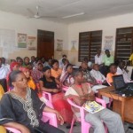
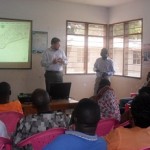
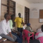
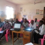
The approaches to paper mapping are well described by Mikel in his blog post called Paper Mapping in Community Meetings. What I would like to add to his points are the reasons why we conducted the paper mapping in the first place. To name a few:
Feedback. To acquire feedback from the wider community regarding the maps and the data collected by a few community members.
Understanding the place. To understand the areas where we are mapping – more accurately, to at least trying to understand complex places like Kibera. Outsiders to communities often overlook this step, and end up conducting projects in communities that they don’t really understand and haven’t taken the time to learn much about.
Acquire more information. We wanted to collect more information and double-check the information collected, find the missing objects, listen to the stories regarding particular issues, and to identify specific problems and solutions to these problems.
Monitoring the accuracy of the mapping. Through community’s input we were able to monitor the accuracy of our mapping endeavor.
These were the reasons I decided I’m going to look closely into these paper/drawn maps and try to understand what the people from Kibera were telling us. I’ve done a similar exercise before with Joshua Goldstein (as a part of Map Kibera) who was at that time working for UNICEF Innovations. We – together with the rest of the Map Kibera team, of course – had created the first, and the most comprehensive Security map of Kibera. Now it was time to focus on other problematic areas, where we also involved community members who drew on our existing map to add information and new issues. For that reason, there were, and still are, some twenty or so drawn, paper maps stored safely away in cyberspace, which cover issue topics ranging from education, health, water and sanitation. To extract useful information from these maps required some Photoshop magic. The first maps I looked into were the water and sanitation maps.
So what did we ask, and what did the community tell us?
Identifying missing resources:
Is it representative?Is anything missing or mislabeled?†were some of the questions we asked to help us see the extent of the missing data. The feedback made us realize that we missed a lot, and it made us realize we need to re-do the mapping.

Missing
Identifying problem areas:
What and where are the biggest problems regarding water and sanitation in the community? Which water points and toilets would you say are the worst and why? Are there many people who use public spaces for toilets?†were the questions which helped us identify the most pressing issues and problems. Some of the major problems identified were:

Major problems/issues
- All streams are used as toilets and dumping sites
- There is a health hazard because the people at times use the railway as a toilet, garbage dump & a cooking point
- Misuse of the drainage system as a dumping site
Stories behind issues:
What would you say are the largest and most direct challenges to providing quality water and sanitation? What is the biggest need regarding water, waste disposal, and sanitation in Kibera? What would you want the Government and other decision makers to know about water, waste disposal, and sanitation in Kibera?†These questions helped us collect stories that lent insight into the complex dynamics of Kibera. Some stories:

Stories connected to water and sanitation
- Different amounts of money is required depending on which toilet you use
- Solid waste management is poor
- Vigilante groups demand money for the toilets which are to be constructed in their area
- Maintenance of toilets is a big problem; toilets get polluted quickly
- For “short calls†people use plastic tins; flying toilets (plastic bags in which people defecate and then throw out of their home) are used at night because of insecurity
- Households use paper bags for waste collection; these bags are then picked up by individuals and groups who bring them to collection points for a certain amount
Mapping mobility:
Where do your collect water? Where do you use the toilet? Where do you dump trash? Why?†By asking these questions we were able to observe the movements connected to the water and sanitation. Some of the findings that came out of the mobility mapping were that:

Mobility connected to water and sanitation
- People dump their trash into rivers, and the rivers serve as collectors of most of the garbage from the slums
- There are some points of data collection within the slum where the city council collects the trash and transports it out of the slum
- People don’t necessarily use the closest toilets and water points but look for the most affordable ones
Solutions:
How would you solve some of the problems you pointed out? In what ways can you envision using this map to improve water, waste disposal, and sanitation in Kibera?†These questions encouraged people to share their views on how to solve certain problems regarding water and sanitation:

Some of the solutions
- Awareness and education
- Need for weekly garbage collection
- More dumping sites, more toilets to be constructed
- Stakeholder involvement – coordination between stakeholders
- Partnership involvement – CBOs, NGOs, and landlords should come on board to make sure that each plot has a sanitary facility/usable toilet
- Triangle: Reuse, Recycle, Reduction programs needed
Paper mapping or drawing exercises proved to be a very useful feedback mechanism and also a very useful tool for planning. The community’s knowledge is priceless and only the community understands and knows all the answers. There’s no point in figuring out something new when the solutions are already available and when all you have to do is just listen!
What we learned out of this process can be best told by quoting an article:Â Participatory mapping and geographic information systems: Whose map? Who is empowered and who dis-empowered? Who gains and who loses? by professor Robert Chambers from the Institute of Development Studies who has been involved with participatory methodologies from the early beginnings, or at least from the first modern scientific endeavors in the field of participatory methodologies:
Before the late 1980s and early 1990s when some of us were so excited at what we were finding local people could do, much indigenous, local and participatory mapping had already taken place in different regions, countries and continents. Mapping and various forms of spatial representation by local people on their own have a long history, and very likely a prehistory!
More remarkable than what local people had already done in mapping and other forms of spatial representation was “our†educated professional ignorance of their mapping abilities.
[Cross-posted from Mapping: No Big Deal]