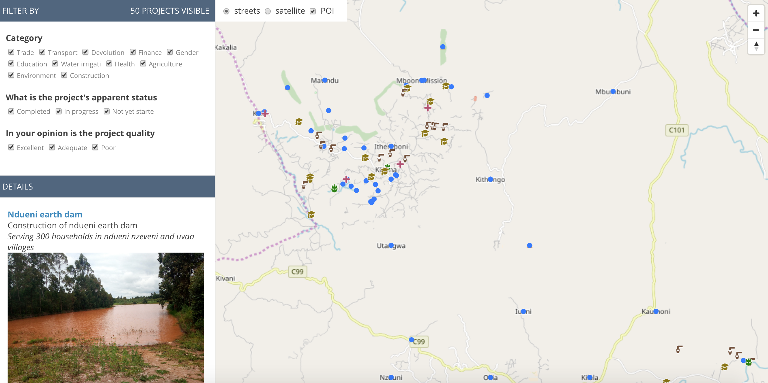
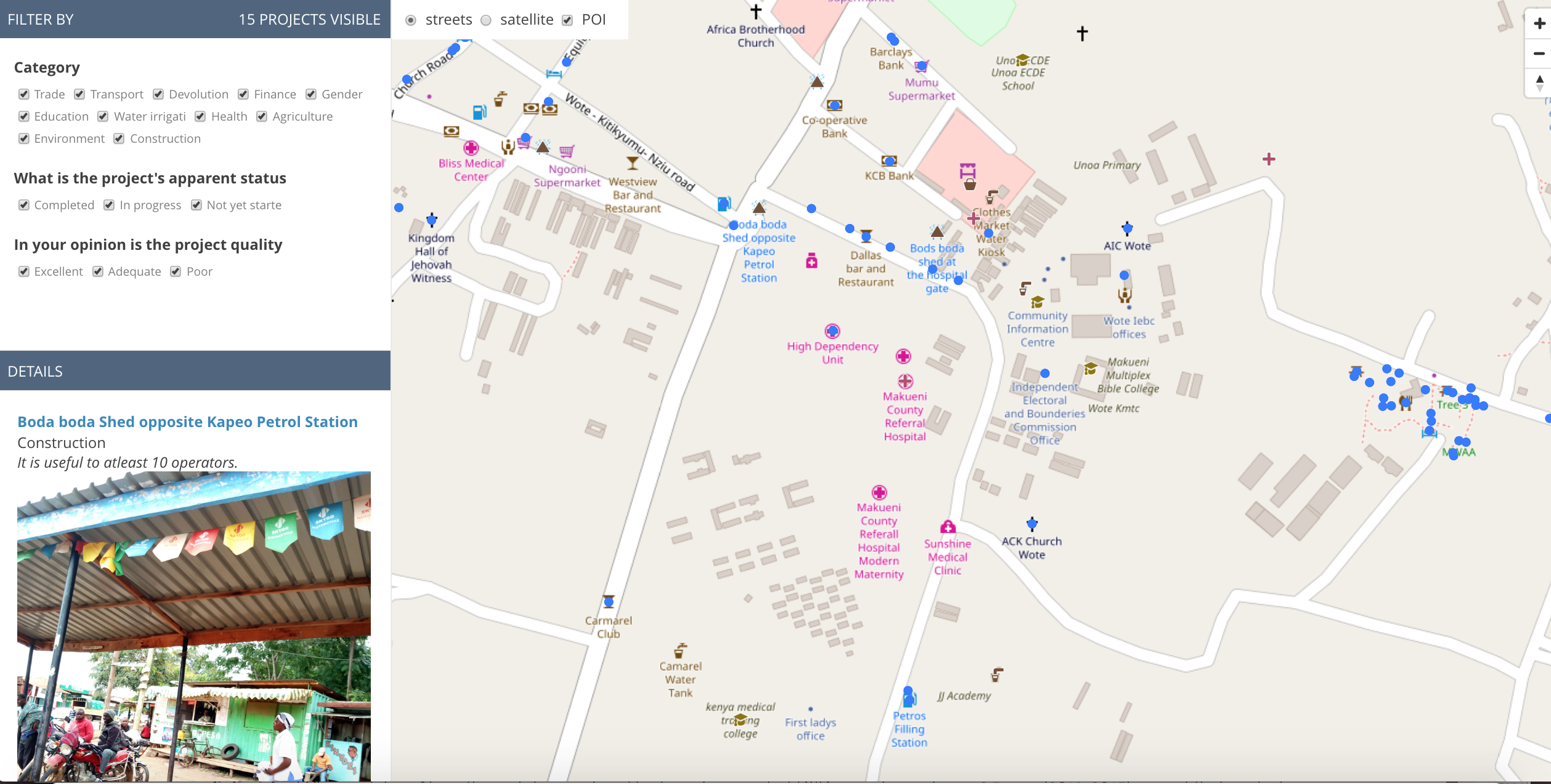
Kenya’s devolution process and constitutional reforms of 2010 means that Kenya’s counties, of which there are now 47, are directly responsible for a much greater amount of their local development. Some counties have integrated citizen participation in planning by embarking on an intensive annual participatory budgeting process, with support from the World Bank. But, in order to allow communities to directly plan and budget for development, counties realized that they needed better information about existing projects and features, best represented geographically. Many times, participatory budgeting (PB) groups were relying on memory or on hand-drawn paper maps of existing terrain and features in order to determine where they should place new water points, health centers, and other key new projects.
To help fill this gap, Map Kibera Trust, along with GroundTruth Initiative, have begun to work with two pilot counties, Makueni and Baringo, to create participatory digital maps with both citizen and county government mappers. Makueni has already been mapped in two pilot wards, including collecting feedback on county development project status and quality. Please see the maps here.
The base map data is, of course, gathered on OpenStreetMap – including various key features such as roads, shops, landmarks, schools, as well as the PB projects themselves. However, the mappers also collect project feedback information using Open Data Kit (ODK) and store it separately. The digital maps are then created using MapBox tools to combine them together. While mapping, participants mark whether the project is completed or not, whether it’s in good shape or poor, and add a sentence about the project’s quality or impact. We intend for this aspect to be updated regularly in preparation for the annual budgeting meetings, so that citizens can get a sense of how their intended projects are faring. Therefore, the map also allows those who take part in the budgeting process to see the extent to which the county is doing what they had intended. Each PB meeting will receive a printed map, so as not to have to rely on digital maps in locations with very little internet connectivity or even electricity.
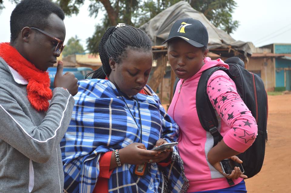
Mobile data collection using ODK in Mbooni ward, Makueni.
Check out this great video showing the mapping in Mbooni ward of Makueni county, also illustrating the challenges of working across rural terrain. By engaging young residents of each locale, we hope to spread participatory mapping throughout Kenya, county by county.
by: Sande Wycliffe December 3rd, 2012 Comments Off on Voice of Kibera takes awareness of its platform to Mashinani “Grassroots”
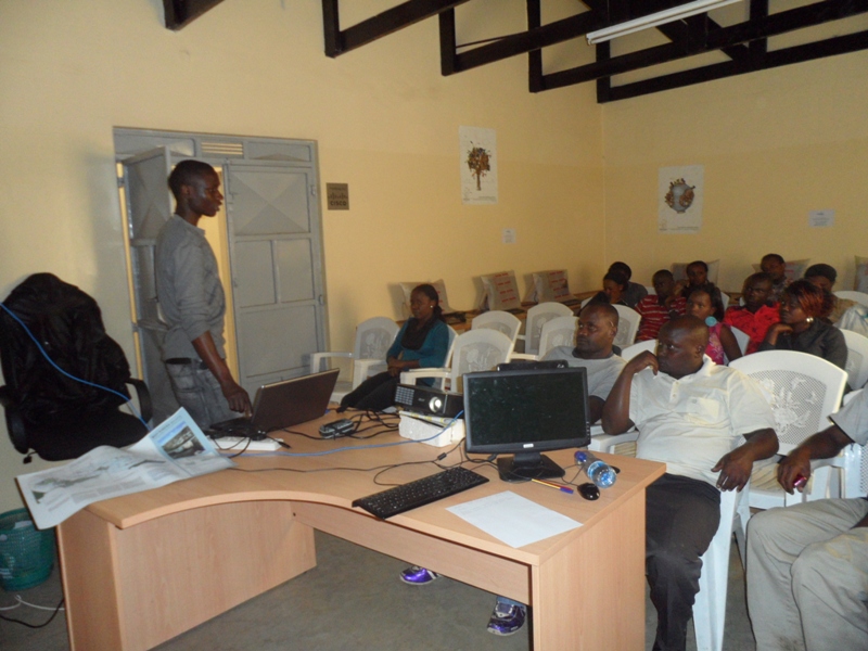
An Attentive Audience at the Meet-up
Introduction:
“I want to play a pivotal role in updating and sharing community generated information with the community and the world at large through citizen journalism. I say so because I witnessed an incident a few months ago during the oil shortage problem, where a CNN journalist came to Kibera slums and paid a woman stage manage some kind or a demonstration saying the price of Paraffin had gone up as he recorded her. I would like to know more about www.voiceofkibera.org so that I can challenge the perceptions and misrepresentations that Kibera goes through.†This was what Ann one of the participants had to say during the introductions session at the meet-up.
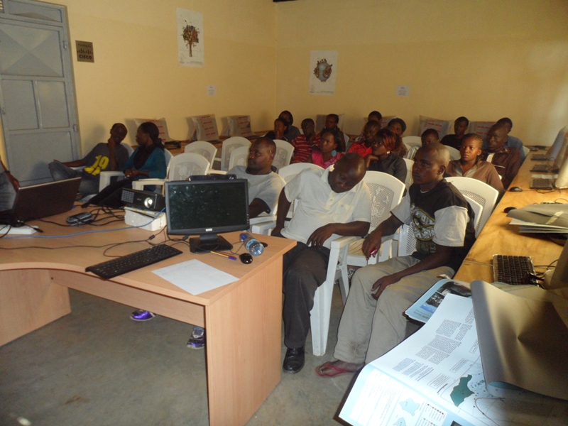
Before then, Map Kibera Trusts’ Voice of Kibera had organized a presentation in Soweto East village to engage the youth group leaders more on how they can get engaged with the platform. Having invited 30 representatives, 22 were able to turn up for the event that started at about 2:15pm on Saturday the 1st of December.Â
Preparations for the day:
Adequate arrangements by the V.O.K team were made to ensure that the days program would run smoothly hence achieving its purpose. Below was the program flow.
Introduction of the entire Map Kibera Trust and Voice of Kibera.
The relationship between Map Kibera Trust programs.
The Voice of Kibera platform and how it works, what the participants think can be improved.
Question and Answer time to enable a brain storming session for better understanding.
Distribution of Maps on 3 themes; Education, Health and security to the line organizations that attended.
Refreshment and Networking
Conclusion
The voice of Kibera Presentation:
This was a step by step presentation done with Fredrick, one of the Map Kibera trust members. I could feel the mood in the hall, one with silence meaning the participants were keenly taking in what was being said. Some of the details that were shared are; How to submit a report, The ways with which you can send the report to the website, the details and importance of categories, editing, proof reading and approving or reports among others.
Fredrick Doing the Presentation in Soweto East
After the session Sande took over to reinforce what had been discussed even as he led the question and answer time.
Some of the questions:
How do you ensure authenticity of the reports you collect?
Now that we have new boundaries, what is your organization doing to that effect?
Do you have anywhere you advertise jobs for the youths in the slums?
 Our Response to the Questions:
That when you have a report and you are not sure about its’ contends, you can get call back the person who send it to get more clarification, if the news has been covered by a 2nd or 3rd parties you can use that as well as using your available networks to get confirmation or more information on the same. Map Kibera is currently remapping the new boundaries by IEBC including information on the location of polling stations so that this information can be available to the locals before the elections in March 2013. We are developing a plartform under the name organizational directory that will see advertisement of opportunities a reality in the sense that those who consume contend do it for free apart from profiling organizations in Kibera on the Platform.
The meet-up that took close to 3 hours came to an end with the p
Having been the first organization to put the entire Kibera slums on the world map, Map Kibera Trust; an organization that seeks to be a hub where access to open information contributes to positive community transformation was on the road again to ensure that the maps that were produced reached the community which in-turn would put them to use.
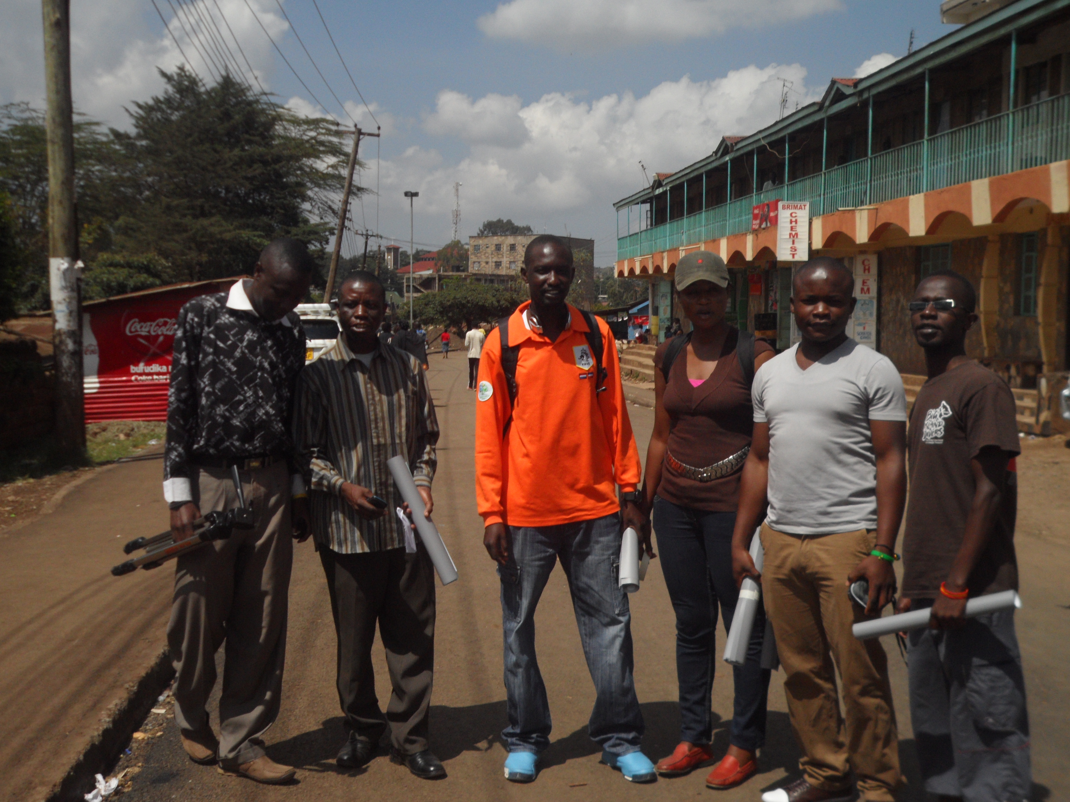
To achieve this, the program coordinators met for the preparation of distributing the maps; there intention of meeting was to bring the attention of the three programs on how they will be working together towards achieving the objective of the exercise and to come up with relevant locations for maps distribution. It was there that they agreed that members from the 3 programs; Mapping, Voice of Kibera and Kibera News Network were to go to the field to distribute the maps which had been developed based on themes. Maps on Education, Security and Health are the themes that were distributed.
The aim of the exercise was to give back to the community through the high quality printed maps that contain the informational that came from them during the first phase of the mapping exercise.
Villages covered.
For the 2 days that we were in the field, we were able to cover all the 13 villages; Gatwikera, Raila, Olympic, Soweto west&east, Kianda, Kambi muru, Kisumu ndogo, Lindi, Mashimoni, Makina, Silanga, and Laini Saba.  Â
Positive Feedback From the Field.
As we visited different places, we collected feedback from the people we found so that we could ascertain how the maps will be put to good used.
The local administration appreciated our work and accepted to be interviewed i.e. Sarang’ombe and Laina Saba ward chiefs.
Most of the institutions accepted to use the map for positive transfiguration most of the institution wanted more than one map so they can use it for informational purposes as well as Education especially the Schools we visited.
We even had a chance to meet with D.O 1 (District Commissioner) who had a compliment for us saying that our map was outstanding compared to the one they had before.
For those who were not able to access our maps online were able to access them on hard-copy something that was important for us since it was now realized.
We ensured equal distribution of maps in at least all villages in Kibera.
Some of the Challenges.
Though most of the places we went to were very receptive, we experienced some hostility in a few areas where we were thought to be a different group out to just take advantage of the situations in Kibera by walking around to talk to people as we take photos to go and sell. After a few minutes of sharing our intentions with them, they understood us and we gave out the maps, something they congratulated us for showing a good example to organizations by sharing the findings of the work done with the community. We also found some schools that were to get maps already closed for holiday which means we will have to give them the maps when they resume school.
Conclusion.
In general, the exercise was a success only for the schools that had already closed. Going forward, we need to print big and more visible maps a suggestion that came from one of the places we visited.
We hope that the maps distributed will not only be put to good use but also help Map Kibera Trust bond more with the community so that even as we get ready to cover the vents before, during and after the elections, we can work together to achieve optimum results and that Kibera and the other slums we are currently working with (Mathare and Mukuru) will never be the same again.
and if you’re curious, a little more detailed Report