Outcomes and Learnings from Open Schools Kenya mapping in Kangemi

by: June 5th, 2019 comments: 0

Mapping distribution

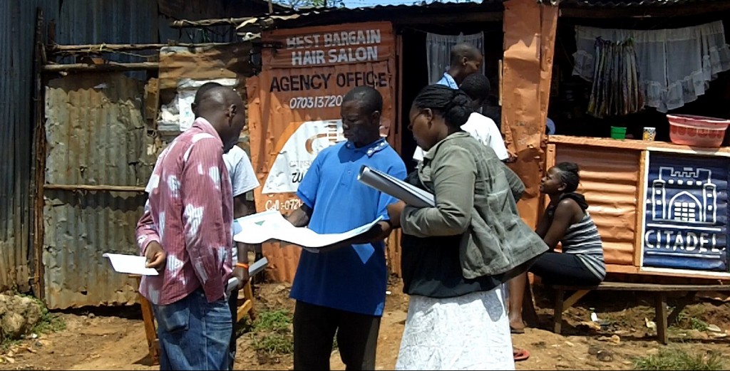
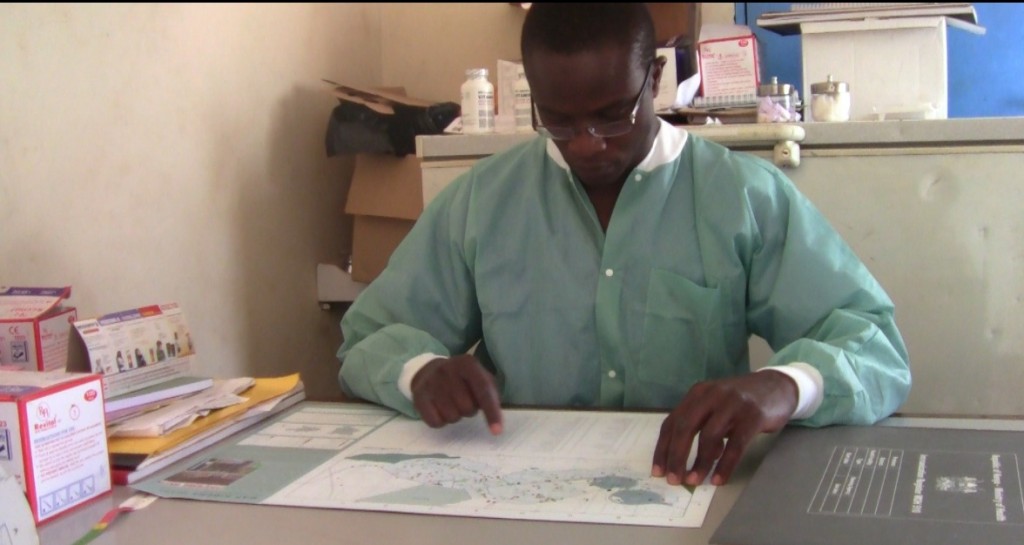
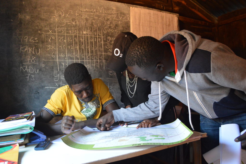
The schools mapping of the Kangemi slum and associated surroundings was a very successful exercise, and provided much-needed information for everyone from Kangemi’s residents and parents to policy advisers and education experts to governmental education officials. The project brought together youth residents of Kangemi with Map Kibera mappers, who, working closely with local school leaders and advocates for informal schools, mapped nearly 300 schools. These now appear on Map Kibera’s Open Schools Kenya school database. The mapping exercise, possible thanks to the support of Indigo Trust, has brought visibility to these schools, and increased both information and knowledge about the number and kind of schools in Kangemi. It has also equipped schools and activists with a key resource in advocating for improvements to and recognition of these schools.
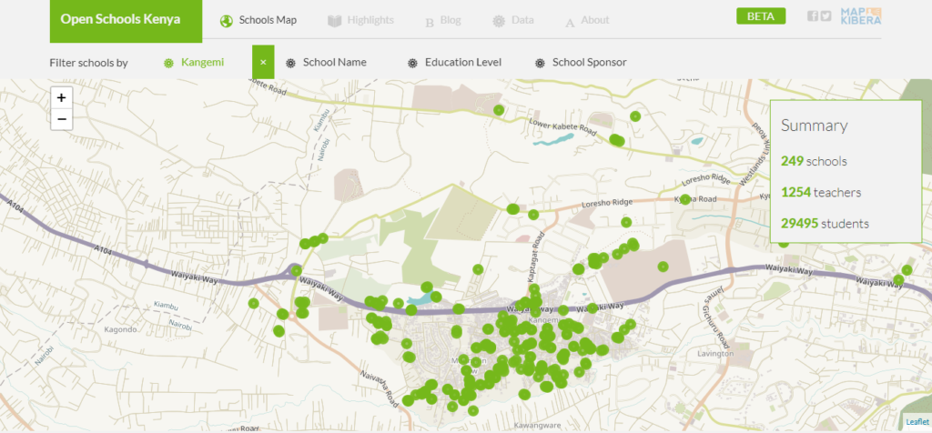
Kangemi Schools Mapping

Just like in Kibera, before the project began, Map Kibera conducted a survey with parents, teachers and government officials to try and understand the information gap in regards to education. Parents, for example, were interested in the distance of a school from their home, how much a school charges, and the ratio of teachers to students before selection a school for their children. Other data points that were collected included the number of students, availability of toilet, school building materials, electricity availability, number of teachers, and many more.

Map Kibera also talked to teachers and school leaders, and met with a number of important figures in Kangemi education. Particularly supportive throughout the exercise was Kangemi’s Alternative Provision of Basic Education and Training (APBET) coordinator, Evans Onchiri. Evans is a tireless advocate and organizer on behalf of the schools, and he particularly welcomed the addition of detailed data and maps to better support APBET schools (APBET is what the schools are now called which were previously known as “informal” or “non-formal”). Map Kibera found that although there is a government policy to recognize these schools — which would allow them to access more resources, have some oversight in place, and be part of the provision of free basic education guaranteed by law to all children — the process of registering under the policy is not clear and has been stalled over several years. Having a better idea of the number of students served and locations of these schools is essential to pushing forward on this policy. The Sub-County Education Director, Phillip Chirchir, and the area Member of Parliament (MP), Tim Wanyonyi also indicated to Map Kibera that they needed a more comprehensive understanding of the schools in their area.

The schools mapping exercise covered both the schools already on local leaders’ lists, and also unknown schools found directly in the field. From the initial main focus areas of Kangemi, which included Kangemi ward and Mountain View ward, the schools mapping exercise was expanded to other slum areas, following the request of the Sub-County Education Director and the area Member of Parliament. The additional mapped areas are the following: Kibagare slum, Deep Sea slum, and Githogoro slum. All the mapped areas fall into the Westlands Sub-County. The total number of the mapped schools is 282, out of which only 19 are public schools, including pre-primary, primary and secondary levels. Therefore, the majority of schools (263) are APBET schools.

A few outcomes:

Seven youth have been trained in Kangemi on how to collect data using the OpenDataKit app, how to edit maps using JOSM software, and how to upload data onto OpenStreetMap. The youth reported a general satisfaction about the additional skills learned. After the completion of their work, the youth mappers reported raised awareness and general knowledge about their own community. Moreover, the new team of trained mappers in Kangemi could be further involved in updating schools’ information and in other related local developments.

The website Open Schools Kenya has been made mobile-friendly so that it can be easily viewed and used on a smartphone. Previously, due to the difficulty navigating a map on a small screen, the site was best viewed on a laptop. Thanks to feedback from users at schools, we prioritized making sure that they can also navigate the site using their phone’s mobile browser. This makes the data much easier to access. Additionally, we worked on the submission form for data corrections, making it more user-friendly and better suited to the needs of schools to submit changes.

The schools and teachers have been very happy about the project. In the first phase, they reported interest in knowing the location of their own school and of the other schools in the area, in particular, to better know the number of pupils, the facilities and the services provided by the other schools. After the mapping exercise was completed and the schools received the printed map, they reported surprise at being able to see the outcomes of the project. In fact, during past experiences, many researchers went in the area collecting data without going back afterward for community restitution and feedback. Moreover, they reported general excitement for being able to locate their own school on the map and to be able to display the printed map in their office for multiple purposes. The schools also highlighted the importance of the online school page. Having their own specific page on OSK, they are now able to easily update the information, advertise and fundraise for their school, and also help engage parents in the community in decision-making about where to send their sons and daughters to school and increase the quality of their education.

Key local education officials were particularly pleased with the outcomes of the mapping exercise. Both Ms. Esther Kimani, the Sub County Quality Assurance Officer, and Mr. Phillip Chirchir, the Sub County Director of Education, highlighted the importance of being able to locate the schools, especially APBET schools, and to have the head teacher’s contact for each school on the OSK website. They are now able to better reach out to the schools and advise the Ministry of Education about their needs.

Map Kibera is now collaborating with education specialists from local organizations Each Rights and African Population and Health Research Centre (APHRC) to include the data and findings of the mapping in their advocacy and policy advising. With their assistance, already Map Kibera has presented the schools’ map to the National Council for Nomadic Education (NACONEK), which oversees APBET country-wide, at a joint meeting discussing schools information and potential mapping of all the APBET schools in Nairobi. Map Kibera has also been working with the Kangemi Resource Centre, a local CBO, to establish a workspace for the Kangemi mappers and to develop joint plans for updating the schools’ data regularly. All three of these key partners also presented at the launch event, which allowed them to connect with the various Kangemi school leaders and share some of their advocacy work.

The schools mapping in Kangemi and beyond led to an increased awareness of existing schools and resources within the community itself. As a teacher from a school in Githogoro slum stated, the schools in these marginalized areas are usually left out from development in Westlands. Both the map and the website are therefore crucial to make visible and clear their presence in order to assure their inclusion into the public education system and the overall education policymaking and planning.
Voice of Kibera takes awareness of its platform to Mashinani “Grassroots”

by: December 3rd, 2012 Comments Off on Voice of Kibera takes awareness of its platform to Mashinani “Grassroots”

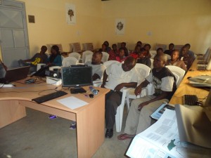
An Attentive Audience at the Meet-up

Introduction:

“I want to play a pivotal role in updating and sharing community generated information with the community and the world at large through citizen journalism. I say so because I witnessed an incident a few months ago during the oil shortage problem, where a CNN journalist came to Kibera slums and paid a woman stage manage some kind or a demonstration saying the price of Paraffin had gone up as he recorded her. I would like to know more about www.voiceofkibera.org so that I can challenge the perceptions and misrepresentations that Kibera goes through.” This was what Ann one of the participants had to say during the introductions session at the meet-up.

Before then, Map Kibera Trusts’ Voice of Kibera had organized a presentation in Soweto East village to engage the youth group leaders more on how they can get engaged with the platform. Having invited 30 representatives, 22 were able to turn up for the event that started at about 2:15pm on Saturday the 1st of December. 

Preparations for the day:

Adequate arrangements by the V.O.K team were made to ensure that the days program would run smoothly hence achieving its purpose. Below was the program flow.

  • Introduction of the entire Map Kibera Trust and Voice of Kibera.
  • The relationship between Map Kibera Trust programs.
  • The Voice of Kibera platform and how it works, what the participants think can be improved.
  • Question and Answer time to enable a brain storming session for better understanding.
  • Distribution of Maps on 3 themes; Education, Health and security to the line organizations that attended.
  • Refreshment and Networking
  • Conclusion

The voice of Kibera Presentation:

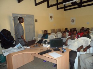
This was a step by step presentation done with Fredrick, one of the Map Kibera trust members. I could feel the mood in the hall, one with silence meaning the participants were keenly taking in what was being said. Some of the details that were shared are; How to submit a report, The ways with which you can send the report to the website, the details and importance of categories, editing, proof reading and approving or reports among others.

Fredrick Doing the Presentation in Soweto East

After the session Sande took over to reinforce what had been discussed even as he led the question and answer time.

Some of the questions:

  • How do you ensure authenticity of the reports you collect?
  • Now that we have new boundaries, what is your organization doing to that effect?
  • Do you have anywhere you advertise jobs for the youths in the slums?

 Our Response to the Questions:

That when you have a report and you are not sure about its’ contends, you can get call back the person who send it to get more clarification, if the news has been covered by a 2nd or 3rd parties you can use that as well as using your available networks to get confirmation or more information on the same. Map Kibera is currently remapping the new boundaries by IEBC including information on the location of polling stations so that this information can be available to the locals before the elections in March 2013. We are developing a plartform under the name organizational directory that will see advertisement of opportunities a reality in the sense that those who consume contend do it for free apart from profiling organizations in Kibera on the Platform.

The meet-up that took close to 3 hours came to an end with the p

Map Kibera Trust on a map distribution drive in Kibera Slums

by: December 3rd, 2012 comments: 0

Having been the first organization to put the entire Kibera slums on the world map, Map Kibera Trust; an organization that seeks to be a hub where access to open information contributes to positive community transformation was on the road again to ensure that the maps that were produced reached the community which in-turn would put them to use.

To achieve this, the program coordinators met for the preparation of distributing the maps; there intention of meeting was to bring the attention of the three programs on how they will be working together towards achieving the objective of the exercise and to come up with relevant locations for maps distribution. It was there that they agreed that members from the 3 programs; Mapping, Voice of Kibera and Kibera News Network were to go to the field to distribute the maps which had been developed based on themes. Maps on Education, Security and Health are the themes that were distributed.


The aim of the exercise was to give back to the community through the high quality printed maps that contain the informational that came from them during the first phase of the mapping exercise.

Villages covered.

For the 2 days that we were in the field, we were able to cover all the 13 villages; Gatwikera, Raila, Olympic, Soweto west&east, Kianda, Kambi muru, Kisumu ndogo, Lindi, Mashimoni, Makina, Silanga, and Laini Saba.   

Positive Feedback From the Field.

As we visited different places, we collected feedback from the people we found so that we could ascertain how the maps will be put to good used.

  1. The local administration appreciated our work and accepted to be interviewed i.e. Sarang’ombe and Laina Saba ward chiefs.
  2. Most of the institutions accepted to use the map for positive transfiguration most of the institution wanted more than one map so they can use it for informational purposes as well as Education especially the Schools we visited.
  3. We even had a chance to meet with D.O 1 (District Commissioner) who had a compliment for us saying that our map was outstanding compared to the one they had before.
  4. For those who were not able to access our maps online were able to access them on hard-copy something that was important for us since it was now realized.
  5. We ensured equal distribution of maps in at least all villages in Kibera.

Some of the Challenges.

Though most of the places we went to were very receptive, we experienced some hostility in a few areas where we were thought to be a different group out to just take advantage of the situations in Kibera by walking around to talk to people as we take photos to go and sell. After a few minutes of sharing our intentions with them, they understood us and we gave out the maps, something they congratulated us for showing a good example to organizations by sharing the findings of the work done with the community. We also found some schools that were to get maps already closed for holiday which means we will have to give them the maps when they resume school.

Conclusion.

In general, the exercise was a success only for the schools that had already closed. Going forward, we need to print big and more visible maps a suggestion that came from one of the places we visited.

We hope that the maps distributed will not only be put to good use but also help Map Kibera Trust bond more with the community so that even as we get ready to cover the vents before, during and after the elections, we can work together to achieve optimum results and that Kibera and the other slums we are currently working with (Mathare and Mukuru) will never be the same again.

and if you’re curious, a little more detailed Report

and a video documentary by KNN

Where Am I?

You are currently browsing entries tagged with indigo trust at Map Kibera.