by: Steve Banner May 7th, 2024 comments:
Despite previous efforts to install lights in Kibera, some through the Adopt-A-Light program initially headed by Nairobi women representative Esther Passaris, and others through the Nairobi County government, there have still been reports of a rise in criminal activities within Nairobi’s informal settlements such as Kibera, Mathare, Mukuru among others.
Previous programs had overlooked the need to actively engage the community in the process of installing lights in our informal settlements, in the quest to achieve the goal of having proper security measures that can protect residents within the slums.
Other challenges that have faced those other programs include frequent blackouts witnessed in slums as a result of tampering with electricity lines, transformers, and power cables.
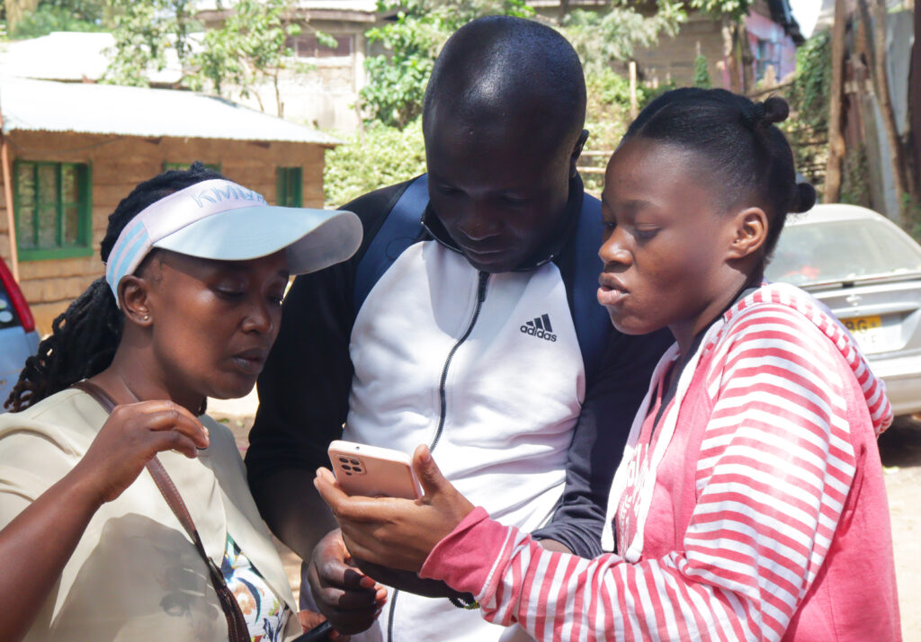
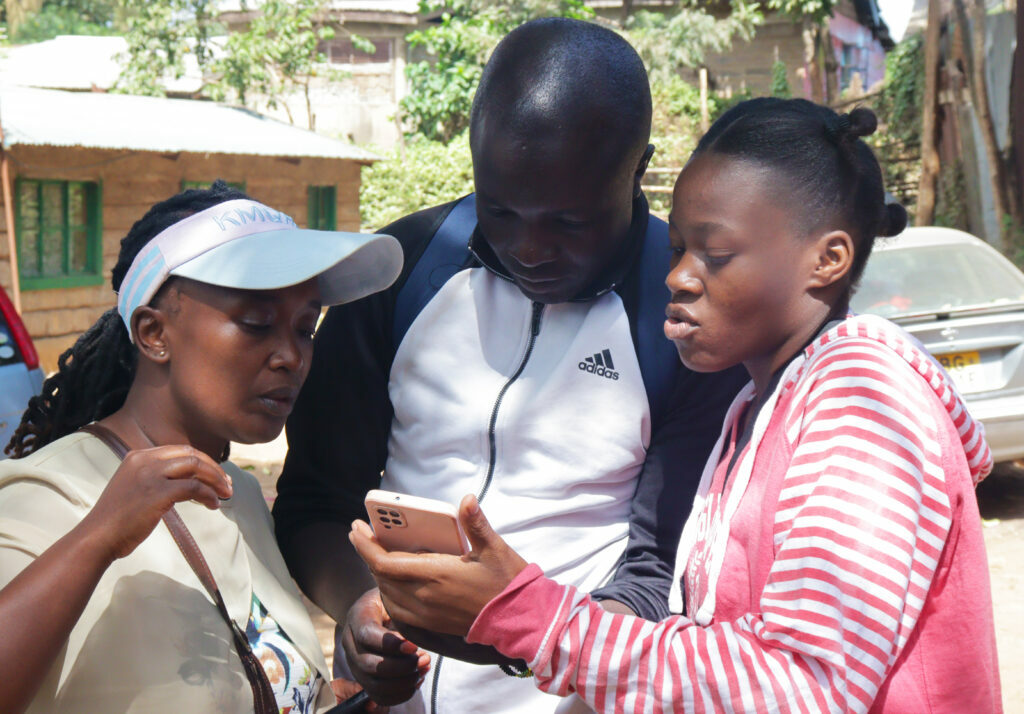
It was for this reason that Map Kibera, Kibera Town Centre, and LIF came together to conduct a ‘Measuring Lights Impact’ survey within Kibera slums, to get the much-needed input and community engagement ahead of solar-powered street lights installments, not just in the streets of Kibera, but also deep inside the residentials.
The survey has been conducted in Gatwekera Village, Kianda Village, Soweto Village, and parts of Makina Village.
Feedback has been good so far, with many residents welcoming the idea of having solar security lights as opposed to electric lights.
Nicholas Ogutu, a Kibera resident who lives in Soweto West village, and works as a construction expert, says his work sometimes involves traveling long distances, and most of the time he has to leave the house in the early morning hours when it is still dark.
“With the lights having been installed in the village, I will not have to worry about being attacked by criminals when I happen to leave while it is still dark outside, and that will have improved my work and by extension, my life” he adds.
Irara, who lives in Kianda village and is waiting to join college, hopes that the lights are installed as soon as possible, to help her while leaving or coming back from her early morning or late night classes in case she will have any, once she joins college.
The survey was conducted by 10 youths from Kibera, who walked from one household or business to the other, with a set of questions that helped to determine the state of security in each village and the location of each light within that said village.

As the project proceeds, we are looking forward to getting more feedback from the residents in the post-installment survey once the lights have been installed in all the designated areas.
by: Zack Muindre November 8th, 2022 comments:
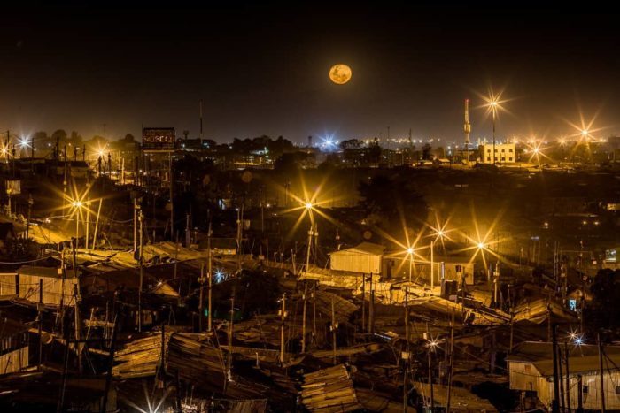
The moon rises above the sky in Kibera.
Photo by © Bryan Jaybee @storitellah #KiberaStories
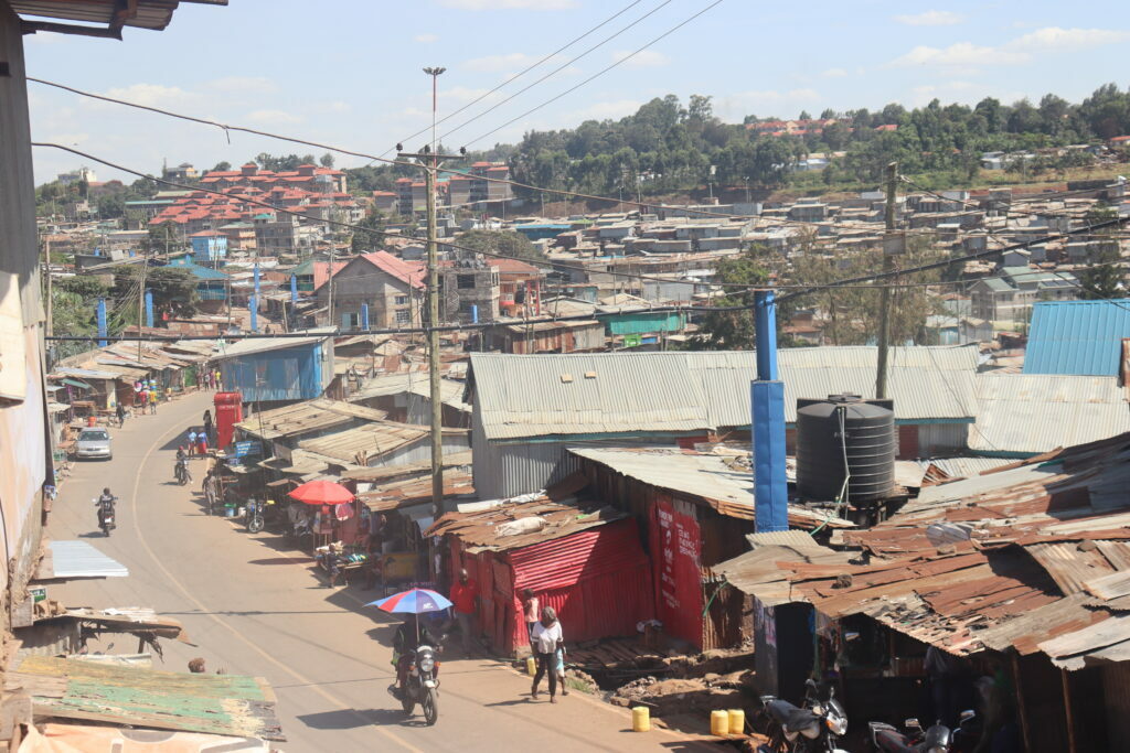
While a lot of efforts have been put in place to light up Kibera, the question that is on every Kibera resident is whether the effort in place is enough to curb the issues of insecurity during the night. Most of the Kibera residents are casual labourers, most working in the industrial area of the city. The rest are either running their small business within the area and others run small groceries that have their pick time in the evening when everyone comes back and needs to grab something for the evening before calling it a day. All these sectors can only thrive if the security of the area is well improved and this can be achieved when various factors are considered such as increase of security patrol by the police, adequate installation of security lights, lighting up dark allies and lastly community policing.
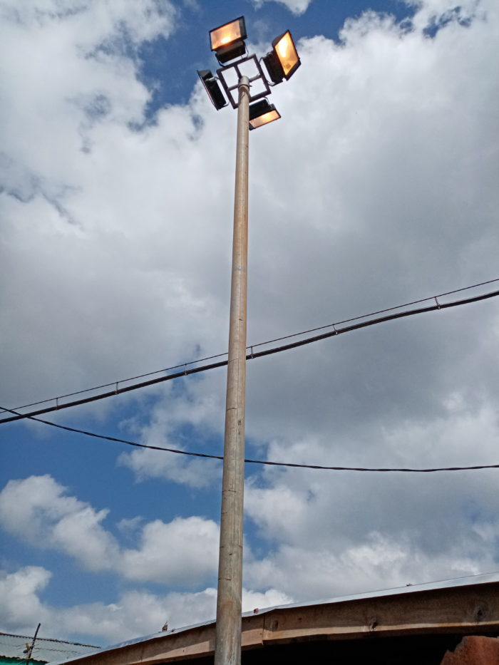
Here I will concentrate more on the second factor that focuses on the adequate installation of security lights in the area. As I started by saying, a lot of initiatives have been carried out in the area to light up the area. This ranges from the adopt a light project that was initiated by the current women representative of Nairobi Hon Esther Passaris. This was the first of its kind in Kibera and it saw installation of several floodlights in Kibera, which lit the areas very well and the residents were so confident that this would address the issue of insecurity, on the other hand, it also provided light to some of the street vendors who couldn’t afford to stay longer through the night because they couldn’t afford electricity or didn’t have enough money to fuel their lanterns. In 2014 Senegalese singer AKON through his project “Akon Lighting Africa” committed to assisting in lighting up Kibera by funding the installation of more security lights throughout Kibera.
What went wrong?
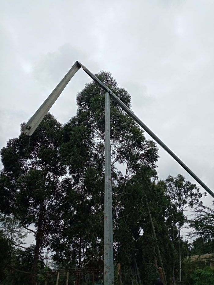
If you visit Kibera, one of the unique features that you will notice cropping out of the rusty rooftops is the high mast of security lights, but once you get closer then you start noticing something is off with them. You will notice some of the lights are faulty “blinking constantly”, others are still on even during the day, while others are either missing the light bulbs or have none. In other cases some have been vandalized and twisted to face the wrong direction, then we have those whose main switch was also vandalized hence the lights are not working.
While these initiatives were well received by the community, we couldn’t help but notice there are a lot of challenges that have been encountered in the process and that led us to conduct a mapping exercise to understand the scope of the effects.
Security lights mapping
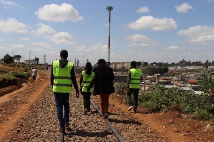
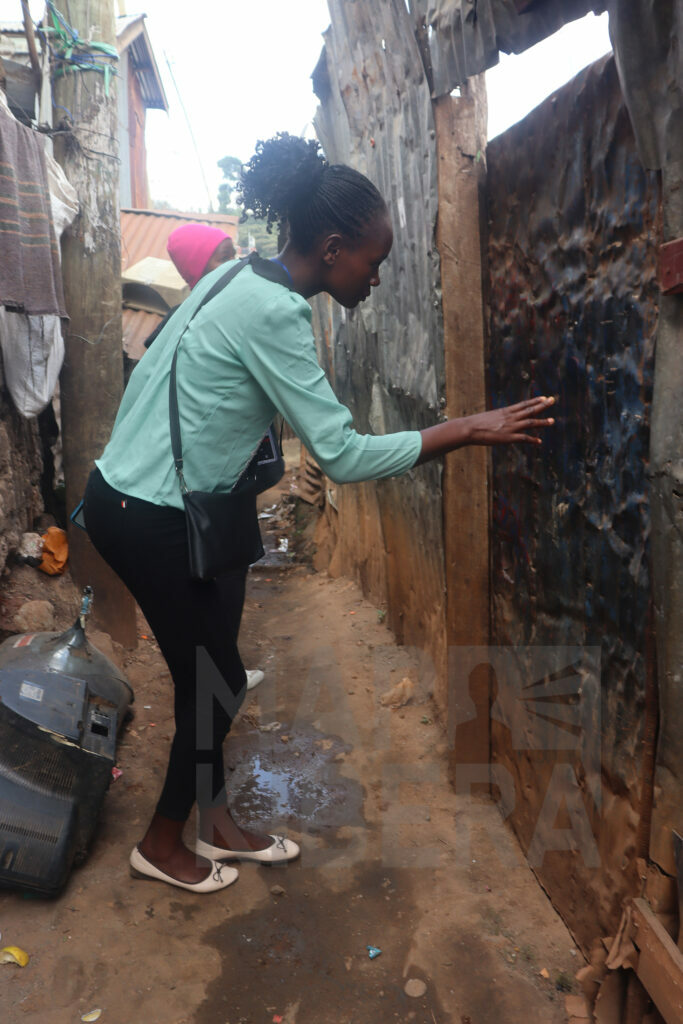
Map Kibera team in the field collecting data.
Mid this year as part of a security mapping project, we planned to revisit some of these sites to update the data that we had collected before. First we checked what we had already and looked for any data gaps that we could collect to create a more substantial case on the issue of insecurity and how it’s linked to how well the areas are lit. After several consultations with various stakeholder we settled on adding the following information:
- Location of the light
- Type of security light
- Who funded the project
- Who does the maintenance of the light
- Who is in charge of operating the light (where it requires one to switch it on)
- What is the source of power
- Number of lights on the pole
- Out of those how many are working
- The colour of the light
- What time does the light switch on
After putting up everything together we rolled out the mapping exercise starting with Fort Jesus estate. The exercise is still ongoing as we had to take breaks in between to work on other things, then followed by the August elections where we put all our efforts into covering the elections. So far we have been able to visit all 13 villages of Kibera and have mapped 431 lights. It has been an interesting exercise where we got to interact with the residents of the area who have openly expressed their concerns and grievances regarding the state of security lights in Kibera such as:
Vandalism
Vandalized streetlight-one of the light bulbs has been stolen.
Another vandalized streetlight-all the light bulbs have been stolen.
The government is putting a lot of effort into ensuring there are adequate security lights in Kibera. The exercise has also experienced huge setbacks through vandalism. It’s so clear that there are those in the community whose businesses thrive in darkness and have made every effort to ensure that these security lights don’t interfere with their work. Thugs have intentionally vandalized the lights either by hitting the lights and breaking them or even going to the extent of stealing the lights, how they reach up the light pole is a story for another day. We also notice that not all vandalism is conducted by the so-called thugs, in places where the floodlights were installed some of the residents found a way of tapping the electricity from the main switch and this has caused the lights to break down.
Lack of regular maintenance
The light has been neglected for months now after it crumbled in the process of installation. According to the local this was a result of using substandard material for the light.
A light stays on during the day, this is due to a malfunction in the sensor.
In some places like Ayany that saw a new installation of security lights by Nairobi Metropolitan Services (NMS) just a few months ago, some of them have already broken down. There are many factors that result in this, but the most common one is due to power surge. Because of how the switch boxes were being vandalized, the authorities opted to connect the lights directly to the main electricity lines. However, the electricity is not well stable, therefore most of the street lights break down due to power surges. Unfortunately, when this occurs it takes a lot of months for the lights to be repaired, in other places, it has taken years for the lights to be repaired, and even when that is done they break down again after a few weeks. Hence the areas are left in darkness despite having the security lights in place.
Uneven distribution of the lights
While some places have security lights almost 5 metres apart, there are other villages like Soweto West and Kianda that only have one or two lights. How this is decided is still unclear but it also shows how some places are still marginalized. I believe it’s right for people to be treated equally and enjoy the same services as everyone else. We are hoping that this data will highlight this high level of inequality and in places where there are few security lights, more will be installed; because the issue of insecurity isn’t determined by an individual’s status quo, it affects everyone and everyone needs to feel safe where they are.
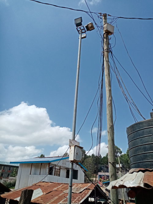
As we await the above issues to be addressed by the relevant offices and offer a lasting solution, we would also like to recognize organizations such Kibera Human Needs who saw the need and launched a project to install solar-powered streetlamps in two villages of Kibera, which has improved lighting of the area at night.
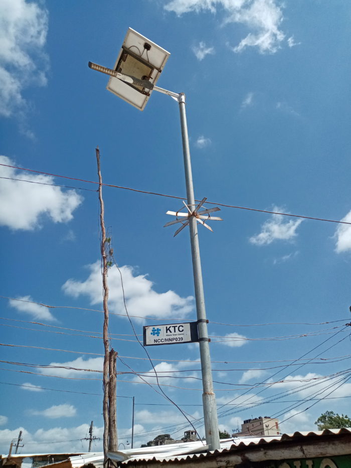
One of the solar-powered streetlamps installed by Kibera Human Needs
In conclusion, fixing the street lighting situation in Kibera will require a lot of partnerships and commitment between residents, local government, and other stakeholders. The best recommendation we have heard from the residents is that many youth groups are open to working with Kenya Power and Lighting (KPLC) and the local authorities to help track and report any arising issue regarding the streetlights. This will help in planning regular maintenance of the streetlights and will also work towards the prevention of vandalism of the electrical cables and light bulbs. The residents need to be involved in all street light projects in order to create a sense of ownership-this will instill a huge sense of responsibility and will prove helpful in the long run.
by: Peter Agenga September 29th, 2022 comments:
Map Kibera recently embarked on the training of high schools in using OpenStreetMap and basic skills in open mapping. In partnership with YouthMappers the training has been customized to go beyond mapping since it aims to promote capacity building that will prepare high school students to join the competitive tech world.
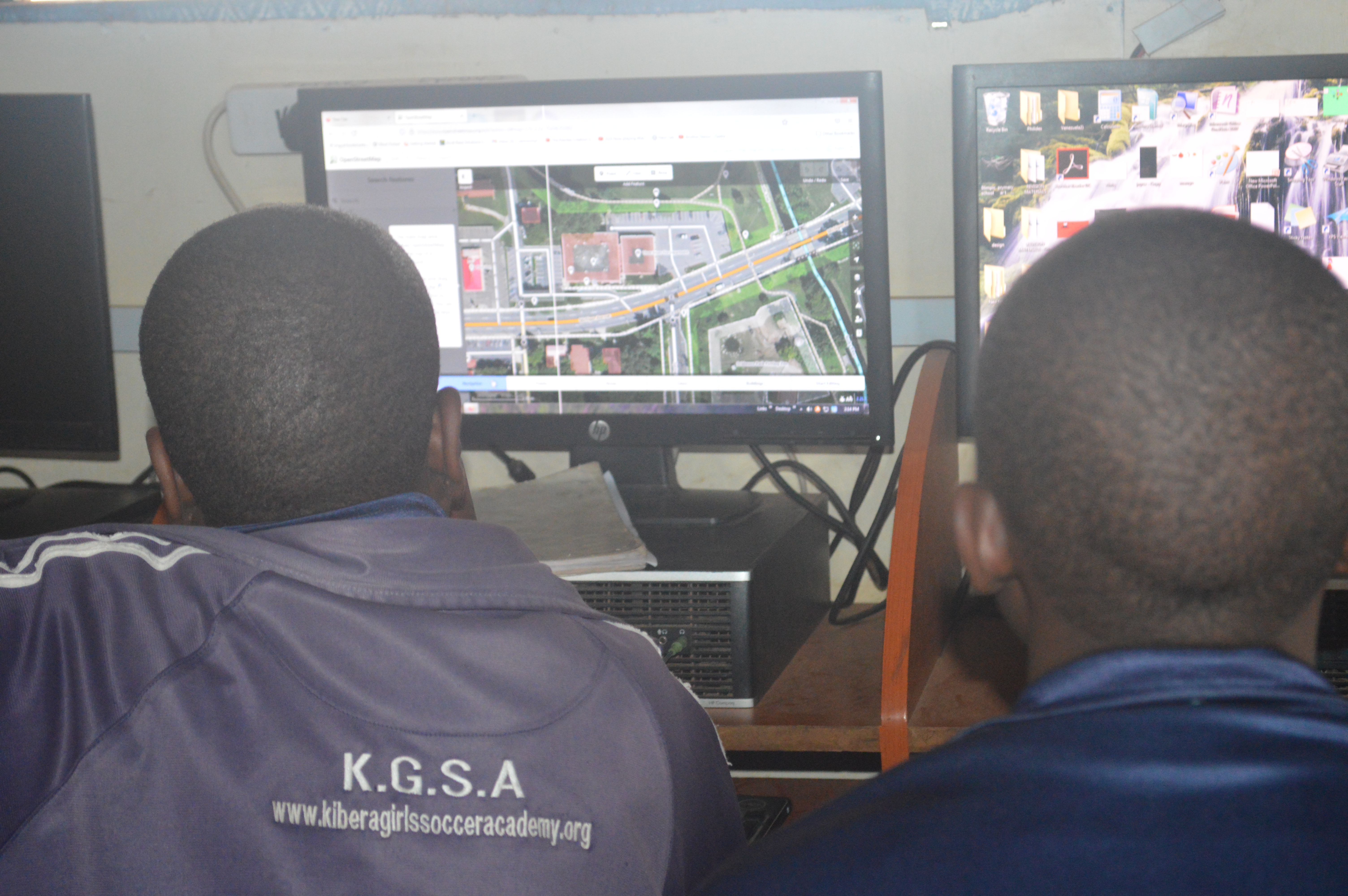
The pioneer school benefiting from this OSM training is called Kibera Girls’ Soccer Academy (KGSA). It is located in Makina village in Kibera.
The school is among the few in the slum that has a decently equipped computer lab in which the students can hone their technical skills.
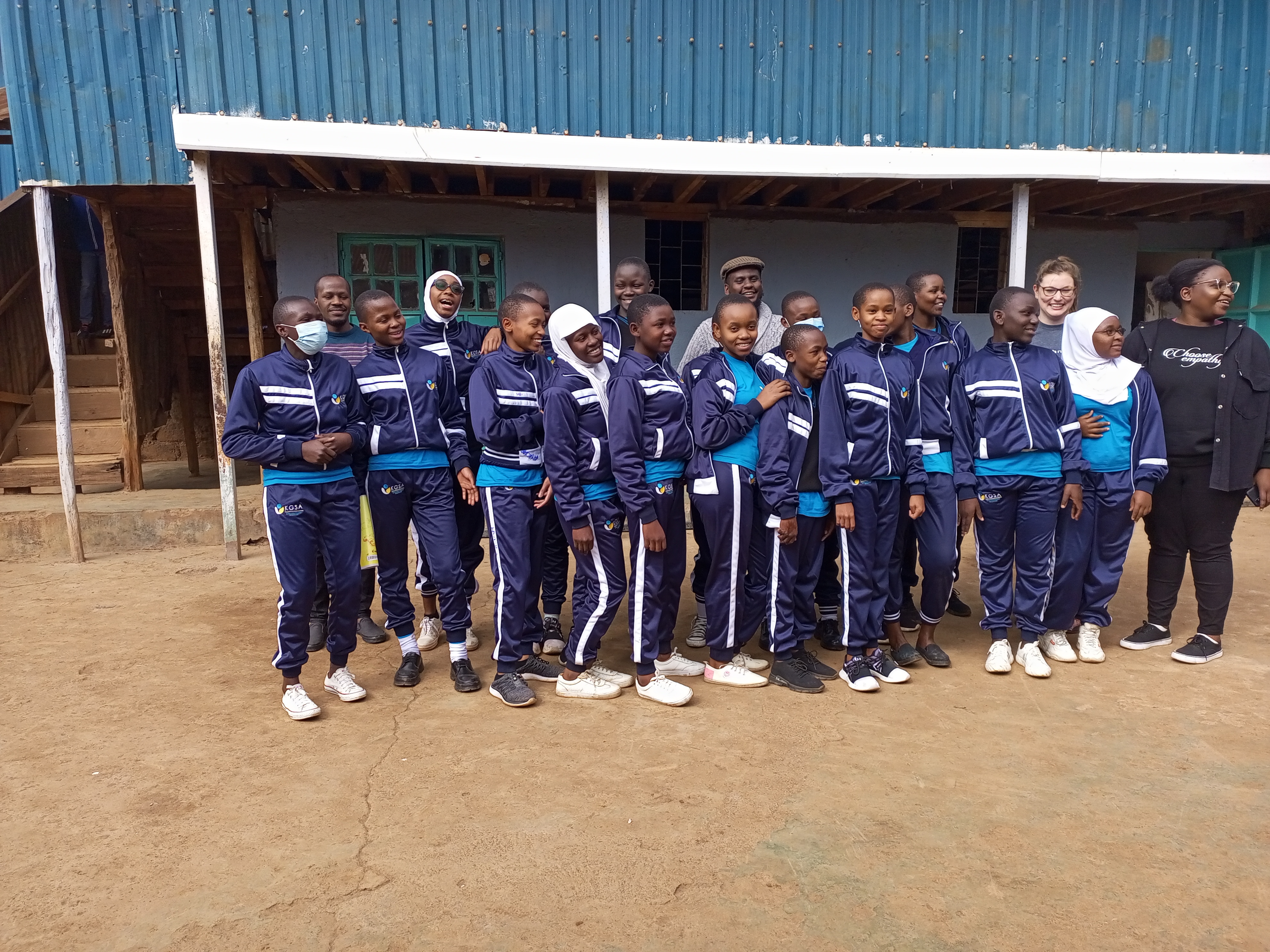 KGSA Students taking a group photo alongside Map Kibera team and YouthMappers’ team representatives
Objectives
The aim of the training program is to achieve the following:
- To ensure inclusivity of marginalized groups i.e. girls (from Kibera) in the technical space of GIS mapping and more. In recent years we have seen lots of women getting involved in open mapping projects, through this training we anticipate having more girls joining the space and also starting them this early. We hope through this that the gender gap that has been experienced in the OSM community will narrow down.
- To equip the students with skills in open mapping specifically on OpenStreetMap
- To introduce high school students to careers in mapping(GIS), Geography, and technology. And whether they take a different path in their country, it’s good to remind them that they can be a doctor or a lawyer and still be an active contributor.
- To increase map coverage by involving more people in open mapping on OSM.
- To explore training different groups i.e. high schools other than universities and organizations on open mapping; so that we can use this as a module to train other similar groups in the country.
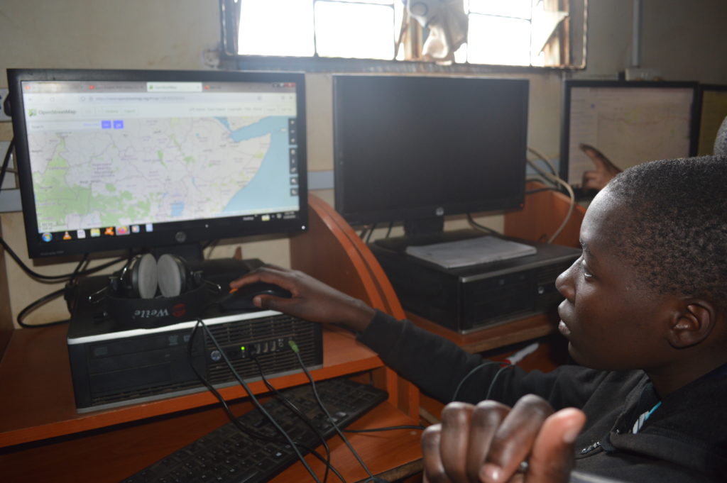
Students getting hands-on editing using iD editor walkthrough
Progress
For this training, we have borrowed the teachOSM module, which is geared at introducing OSM to high schoolers. We have so far covered seven modules out of the twelve in the past three months (May to September).
The training has been open to all students since OpenStreetMap is all-encompassing with regard to the application of open data.

Students use field papers to identify points missing on the map and what needs to be added.

Eye on the data.
Looking forward
- Our earnest desire would be to ensure continuity of the OSM training and probably scale up to other locations of the country.
- We also hope that by the end of the training program, the students will have been equipped with skills that they can build on after their high school diploma.
- The training is also wired to be closely tied to the school curriculum to ensure relevance and harmony with the Kenyan high school education system.