by: Steve Banner May 7th, 2024 comments:
Despite previous efforts to install lights in Kibera, some through the Adopt-A-Light program initially headed by Nairobi women representative Esther Passaris, and others through the Nairobi County government, there have still been reports of a rise in criminal activities within Nairobi’s informal settlements such as Kibera, Mathare, Mukuru among others.
Previous programs had overlooked the need to actively engage the community in the process of installing lights in our informal settlements, in the quest to achieve the goal of having proper security measures that can protect residents within the slums.
Other challenges that have faced those other programs include frequent blackouts witnessed in slums as a result of tampering with electricity lines, transformers, and power cables.
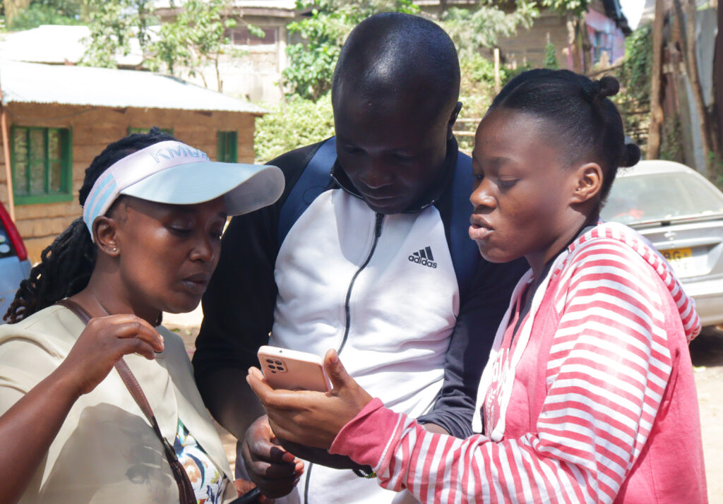
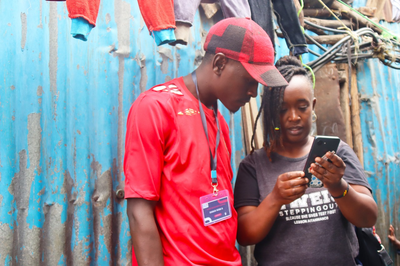
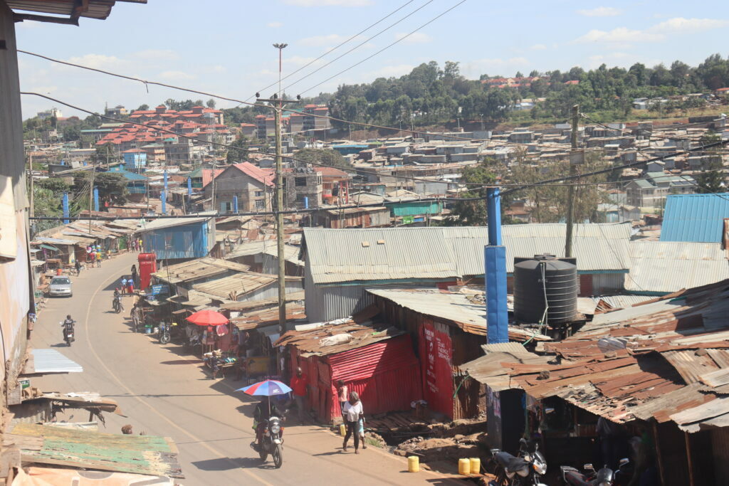
It was for this reason that Map Kibera, Kibera Town Centre, and LIF came together to conduct a ‘Measuring Lights Impact’ survey within Kibera slums, to get the much-needed input and community engagement ahead of solar-powered street lights installments, not just in the streets of Kibera, but also deep inside the residentials.
The survey has been conducted in Gatwekera Village, Kianda Village, Soweto Village, and parts of Makina Village.
Feedback has been good so far, with many residents welcoming the idea of having solar security lights as opposed to electric lights.
Nicholas Ogutu, a Kibera resident who lives in Soweto West village, and works as a construction expert, says his work sometimes involves traveling long distances, and most of the time he has to leave the house in the early morning hours when it is still dark.
“With the lights having been installed in the village, I will not have to worry about being attacked by criminals when I happen to leave while it is still dark outside, and that will have improved my work and by extension, my life” he adds.
Irara, who lives in Kianda village and is waiting to join college, hopes that the lights are installed as soon as possible, to help her while leaving or coming back from her early morning or late night classes in case she will have any, once she joins college.
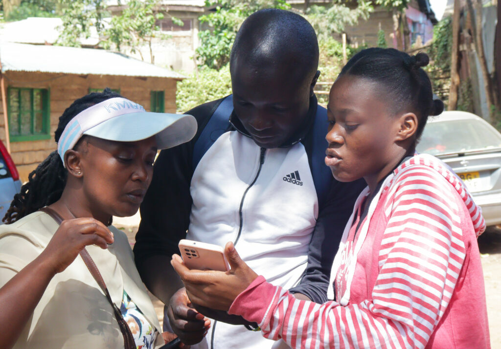
The survey was conducted by 10 youths from Kibera, who walked from one household or business to the other, with a set of questions that helped to determine the state of security in each village and the location of each light within that said village.

As the project proceeds, we are looking forward to getting more feedback from the residents in the post-installment survey once the lights have been installed in all the designated areas.
by: Steve Banner March 6th, 2024 comments:
Mapping waste management in Mukuru Kwa Ruben was an eye-opener to the challenges most people face in our informal settlements in Nairobi, where potential talents and opportunities go unrecognized and a lot of people are not aware of the resources availed to them.
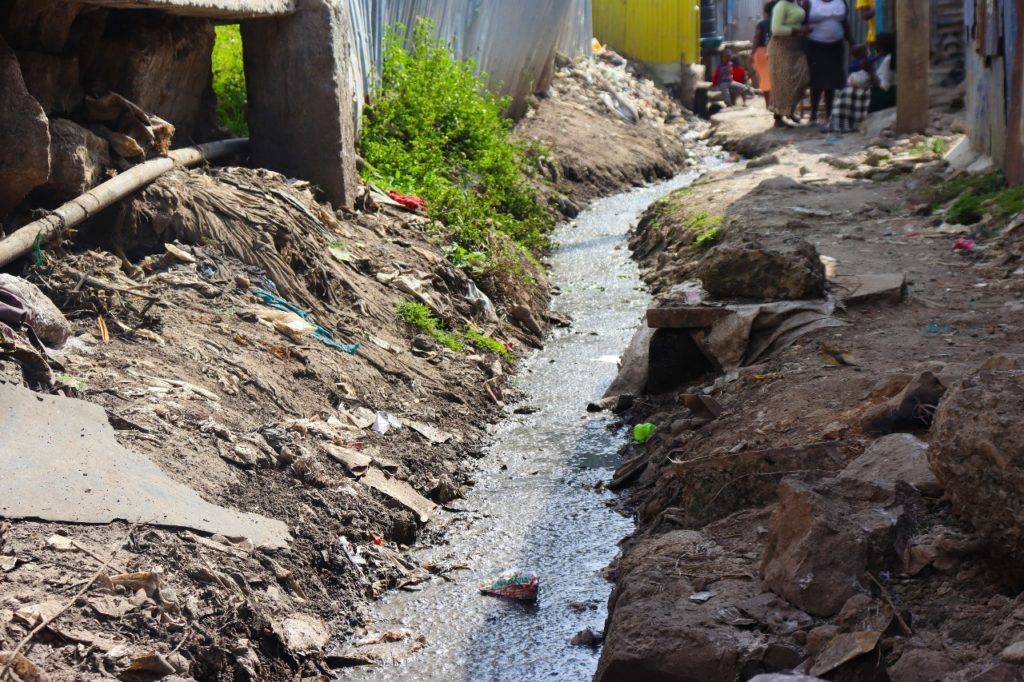
One of the many open drainages crisscrossing the area and offsetting waste into the nearby river.
Mukuru Kwa Ruben is said to be a government reserve for mining industries and that was displayed during our recent waste management mapping where we frequently came across a group of young people working on mining residues to make money.
Like any other informal settlement in Nairobi, Mukuru battles with how to handle their waste and most end up in the drainage system, with a high risk of a dirt-related disease outbreak.
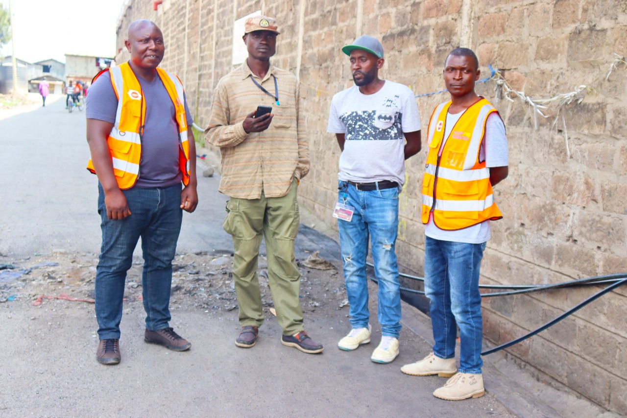
Our mapping started in late December 2023, and went on for about three weeks, which saw it end in mid-January 2024.

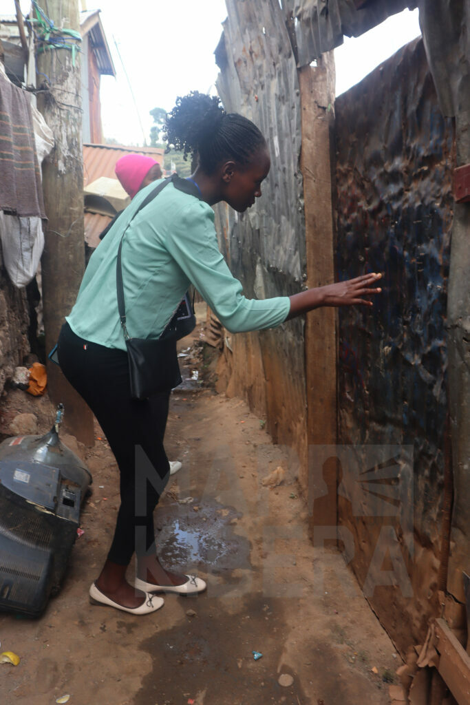
Our field coordinator Lucy demonstrating to one of the enumerators how to pick accurate gps coordinate.
With a group of about 20 youths from Mukuru kwa Ruben, affiliated to Mukuru Youth Oasis CBO, We mapped over 2000 households from Zone A, B, C & D of Rurie village and what stood out the most was the cooperation of the residents and their willingness to have a clean environment.
One of their biggest fear was how the installed bins were going to be managed, most residents could not believe that they were being given quality dumping bins for free.
“Who is going to empty the bins when they are full, and who is paying for that?”, were some of the questions the residents demanded answers for, other than that, they welcomed the idea of having recycle bins in every household of Rurie village.
The mapping was conducted by counting the blocks and finding out how many households and businesses were in a particular block, which helped us determine how many bins to be installed in a particular block.

Some of the youths and leaders of Mukuru Youth Oasis CBO
From the success of this particular mapping exercise in Rurie village, I’m hoping that Map Kibera, together with the partners, will scale to other villages of Mukuru kwa Ruben and by extension, into other informal settlements in Nairobi who are also battling with the challenge of waste management.
by: Steve Banner April 30th, 2019 comments:

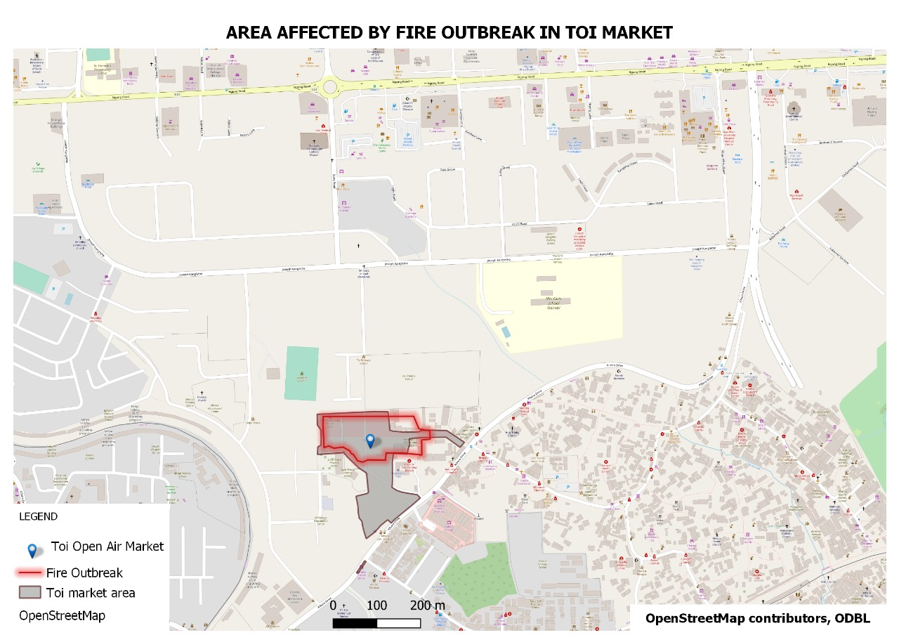
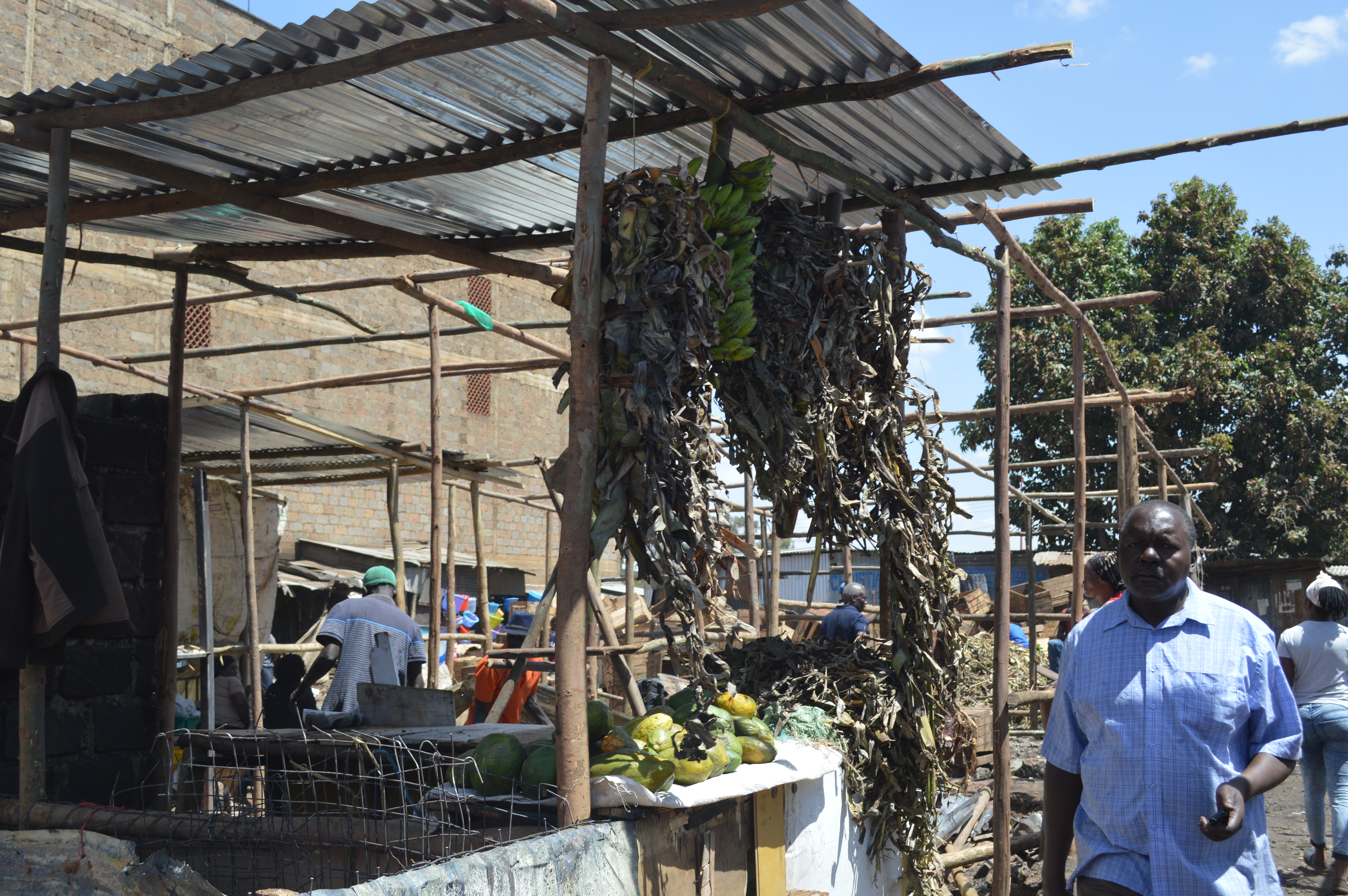
It was on the dawn of 12th March, around 3 am, that Kibera residents woke up to the news that one of the largest markets in Nairobi, Kibera’s Toi market, was on fire.
Most of the traders come from a bit far from the market and so they could not rescue a lot of their goods and ended up losing almost all their properties to the fire.
Those who live in the neighboring villages came together to try and put out the fire using any means they could, including having to literally walk with water buckets to and from the sources of water. One Ramsha Dee Maunda even posted a picture of himself with fire injuries after spending time trying to help put off the fire.

There was heavy presence of the General Service Unit of The Police guarding the market that morning and no one, not even the traders, were allowed to access the market and there was  no explanation given for that, many people were left guessing what the reason for that could be.
Relief came when the former Prime Minister came to speak to the affected traders and, together with the County Government of Nairobi, stepped in and offered iron sheets to help in rebuilding the structures and also help in restructuring their business lives all over again.
According to the traders we interviewed, the iron sheets, worth five million, were still not enough aid to help them restart their businesses again, and most of them turned to money lending institutions to be able to rise again from the ashes and make things work for them.
The market is so far taking back its former shape and glory and very soon, according to most traders, things will be fully back to normal.
“We are only requesting the customers to come back because the market is now operational,” summarizes Mr. Fredrick Mutinda, trader at Toi Market.