 10 years ago Erica Hagen and I were getting ready to start Map Kibera. I read Planet of Slums, was buying laptops on the way to the airport after Crisis Mappers, getting excellent guidance and connections from Ushahidi, and feeling completely overwhelmed. Before we even started, the project was being celebrated in the global media. Heading to Nairobi’s largest slum to make a map. What had we signed up for? I’m looking back on the experience myself now 10 years on, after 6 weeks in a much changed Nairobi.
It’s way way more than I ever imagined. We intended to stay for a month. Through muddy days and very spotty internet, the map took beautiful shape. Zach Muindre and Lucy Fondo and 11 more young people from the 13 villages of Kibera got excited about mapping. That was never going to be enough. That map by itself did not do enough for the people of Kibera, and we felt a deep responsibility to see this work through. We wanted to make the connection to change, for the order and chaos, invention and despair, that city within a city, Kibera. To keep putting the people of the Kibera community in the driving seat on what data was important to them and how it should be used. That impulse quickly inspired citizen reporting and data journalism, with Kibera News Network, still led by Joshua Ogure, and Voice of Kibera.Â
I wrote this in 2013:
In all honesty, the work Map Kibera has set for itself is extremely difficult, steps beyond what is normally attempted, and we have had our share of bumps and scrapes. But anything worth doing takes patience and perseverance, adaptation and learning. We carry on, and we’re ready for what’s next.
Building a team. Mapping and mapping again. Telling stories. Bringing together people to think about data and place. Training and riding the wave of new technologies. Putting maps on walls. Taking the world’s biggest and smallest stages. Fundraising and reporting. Strategic plan after plan. Building several versions of organizations. Advocating to government. Argument. Stress. Triumph. Sometimes all in the course of one day.
After 10 years, has Map Kibera changed Kibera? Yes there’s been significant contribution over the decade in Kibera. And around the world. We’re certainly not done, 10 more years for sure. It’s certainly hard to assess the impact of 10 years. Here’s a few ways I look at it.
Personally, I’ve carted recovered organization documents in a wheelbarrow across Kibera, fended off local youth looking for payment for “securityâ€, waited for ages for a government official to sign a letter, met with ambassadors, and a thousand other unique experiences I never would have had otherwise. I got to know a unique place well.
There’s the data. I’m not going to try to quantify it, but it’s both wide in location and deep in the detail collected. Kibera was mapped and mapped again. Almost all of the slums in Nairobi — Mathare, Mukuru, Kangemi, and others — mapped. Outside of Nairobi, cities and rural areas across Kenya, from Kwale to Baringo, have been mapped. Not just mapped, but mapped by and for community members in each of those places. And the places in between, by the OSM community, inspired and connected by Map Kibera’s pioneering work. All of this data within the infrastructure and community of the global OpenStreetMap project, the foundation of all this work.
It took 3 years for me to feel at last satisfied that Map Kibera had an impact in Kibera itself. It takes at least that time to build trust, to show that an effort is not a flash in the pan, and figure out exactly how something as abstract as data and maps can make a contribution. The 2013 election saw mapping for peaceful elections, building strong networks, distribution of maps within the community and to security services and government, debates and interviews with candidates, monitoring and reporting through all phases of the election — from registration, primaries, campaigning, elections, results, and follow up — after the national and international media left. It made a difference. Voice of Kibera and Kibera News Network really found their stride, reporting from polling stations, and doing video interviews with candidates. OpenSchoolsKenya brought visibility to all kinds of schools in Kibera (and Mathare and Kangemi), that parents, teachers, administrators, and government lacked. Kibera is currently mourning the loss of MP Ken Okoth, who championed the work of Map Kibera and put schools data to work to successfully advocate for more educational resources. There were many other projects that had an influence on water and sanitation, health, food security — their impact less visible, behind the scenes. This data has been used by organizations large and small to orient, track and ground work in all these places. We know of some of them, but so many more we have no idea about because the maps are open to all.
Male erection is a complex process. It involves the male brain, nerves, hormones and blood vessels. Erectile dysfunction may indicate a malfunction of any of these elements. When you are going to start taking Cialis 20mg tablets, consult with your doctor first and inform him about your health issues. And stop taking Cailis immediately if you feel not good after intake of this medication. Erectile dysfunction is an indicator that one of these systems is malfunctioning and may be a disease.
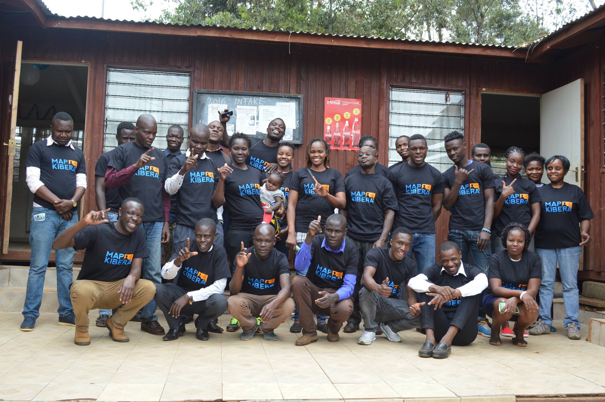
All of this progress requires money and an organization. From JumpStart International’s small bet on us at the beginning, to Unicef, US Institute of Peace, Hivos, Omidyar, Plan, Indigo Trust, World Bank, Map Kibera has had the attention and resources of international development. We are deeply appreciative. And deeply challenged. Matching a project rooted in grassroots community to global development has not been easy. The project cycles and organizational expectations don’t fit long term community development. Looking back now on countless proposals, work plans, reports, strategic planning sessions, organizational charts. And we did not come to this experienced in building organizations, and made our biggest mistakes in misapplying parts of models of a worker’s cooperative, community organization, traditional NGO, and company, lately finding stride in a combination of those. For the past 5 years, Erica has focused so much effort to pull this work together, as have Joshua and Zack, who have devoted themselves on a day to day basis well beyond the call of duty to keep the vision alive. Map Kibera remains deeply focused on Kibera, while being the leading organization for developing community mapping across Kenya, as well as globally networked and linked. It’s not easy to connect a grassroots community effort to a global perspective and industries. I think they’ve finally found an operational groove 10 years on.
Around the world, Map Kibera became an inspiration for a new kind of community mapping, one that was simultaneously rooted in community development, and also integrated into the global data infrastructure of OpenStreetMap. Map Kibera has served as a template and model for countless other projects. As Erica and I began our return trip to Kenya in January 2010 to work with Map Kibera for another year, Haiti was struck by an earthquake, and Humanitarian OpenStreetMap Team’s first effective activation began. After many stolen early morning moments during our “vacation†coordinating the Haiti response, I helped plan post-emergency activities of HOT on the ground in Haiti, modeled directly on Map Kibera. The Map Kibera team also started the OSM mapping effort in Dar es Salaam, in Tandale, which has now covered the whole city of Dar for flood risk mapping. It was our mapper Lucy, still a key Map Kibera team member, who traveled to Dar to train communities in OSM back in 2011. Regularly, even just last month, I hear from people starting mapping projects inspired by Map Kibera.
This influence flowed from an incredibly strong story — young people putting this large and famous and yet “invisible†settlement on the map. Map Kibera has been profiled by CNN, PBS, New Scientist, National Geographic, Wired, Al Jazeera, Le Monde, and The Guardian. It’s taught in schools, every geography undergrad seems to watch The Geospatial Revolution — it’s even a part of on-boarding for some teams at Mapbox. Map Kibera has been featured in the Smithsonian and other museum exhibits, in popular science books and coffee table books of critical cartography. It’s been referenced in hundreds of research publications. Though I happen to believe the best research on Map Kibera has been done by its practitioner, with Erica authoring good pieces early on for MIT, and more recent learning retrospective for Making All Voices Count. Erica has told the Map Kibera story on the TED Stage. I’ve shared in Seoul, Zach has presented in Hyderabad, and Josh everywhere from New York to Azerbaijan.
But ultimately, the best way I know to track the influence is in the people we’ve gotten to work with. Impossible to name them all. Some have come and gone, and some have stayed all the way through — Zach and Lucy are still mapping, training government officials, and leading the roll out of projects. Josh is the general manager and has brought KNN to a level on par with professional news agencies, along with Steve Banner and Jacob Ouma, who also have been with us from the early days. They are now as old as I was when this all started. Erica — who dropped everything to come to Kenya with me, then married me, and who has put everything into continuing the effort even after my attention has gone elsewhere. Unbelievable to think back to the 13 young kids who took a chance on this crazy project.Â
So we’re going to celebrate and I hope to see everyone. Map Kibera is throwing a party tonight, August 16 to celebrate the first 10 years, and 15 years of OpenStreetMap. Find the details here and let is know if you’ll join us to raise a glass to 10 years of Map Kibera.
As the year 2018 has just began, everyone is busy writing resolutions, some reviewing what worked last year and what they need to change while others are writing new resolutions for the year. We at Map Kibera also took time to reflect on how the year 2017 was for us in terms of the work that we were able to do.
Security mapping/election monitoring
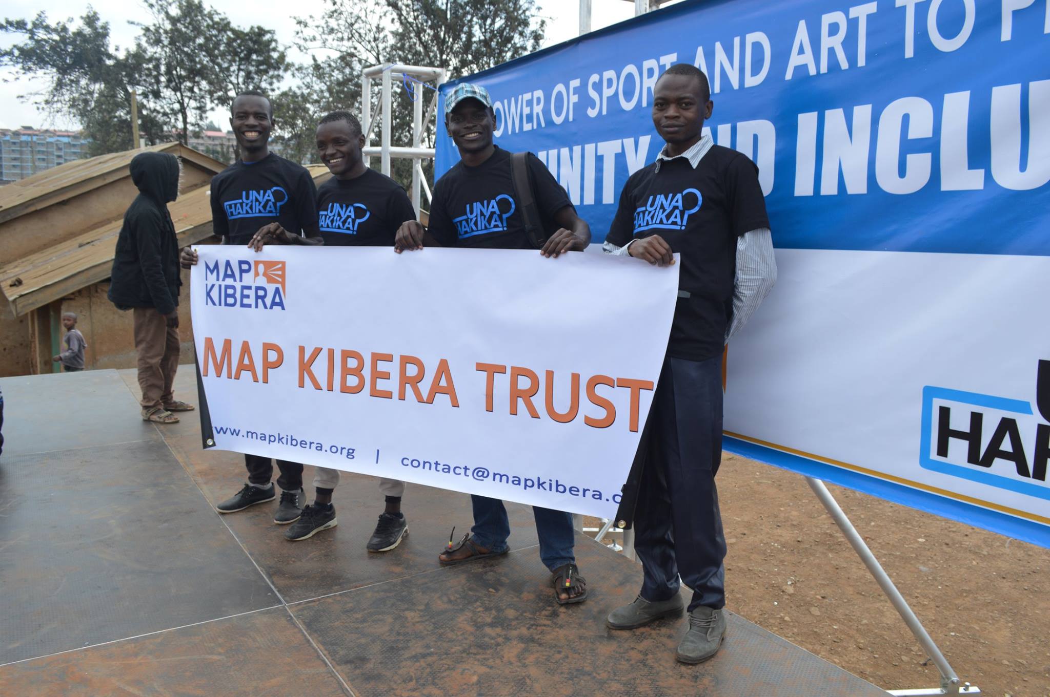
Una Hakika Project
The year began on a good note with the team in Map Kibera conducting a baseline survey for a project that they would be implementing in Kibera in partnership with the Sentinel Project. The project was dubbed Una Hakika? (Are you sure?), and the aim of the project was to assess and moderate the spread of rumours before, during and after the August election.

Una Hakika launch event at Undugu Ground in Kibera
With the August election drawing near, Map Kibera with the help of 3 students from University of Nairobi and JKUAT who were on internship through the Youth Mappers programme conducted a mapping exercise with the help of local community ambassadors drawn from the Una Hakika project.
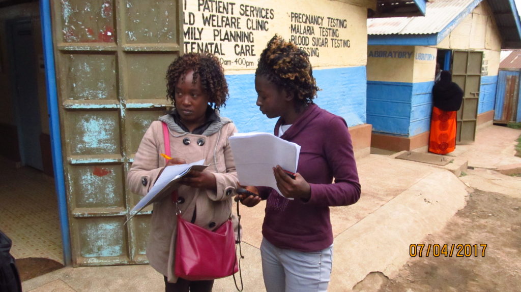
Lucy Fondo (on the left) and Phylister Mutinda collecting data in the field
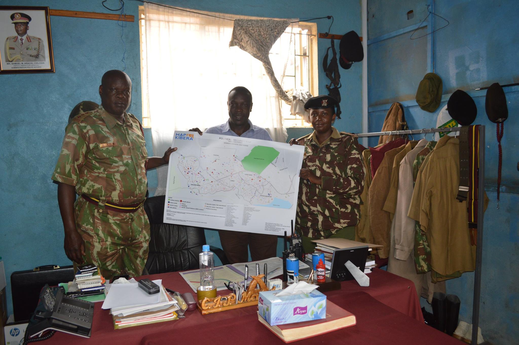
This was to update the security map that was last updated during the 2013 elections. The printed copies of the maps were distributed to the local administrative officials as well as to NGOs that work in Kibera on peace initiatives.
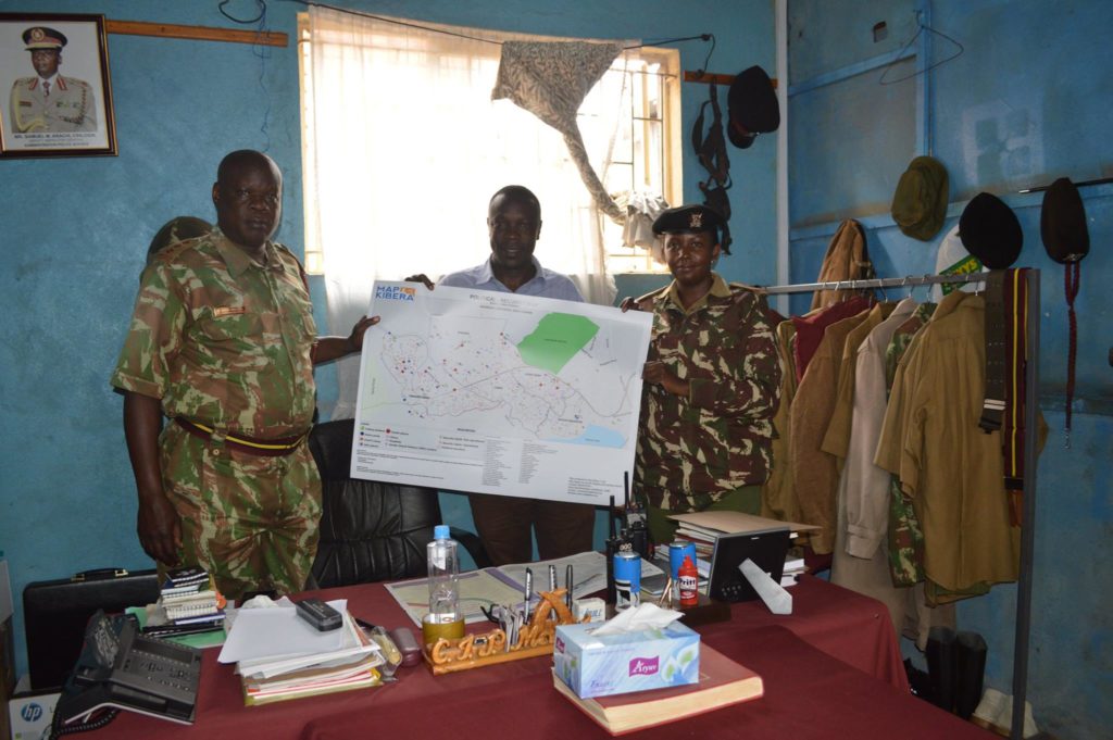
Joshua Ogure issuing a copy of the security map to Adminstration Police commandant
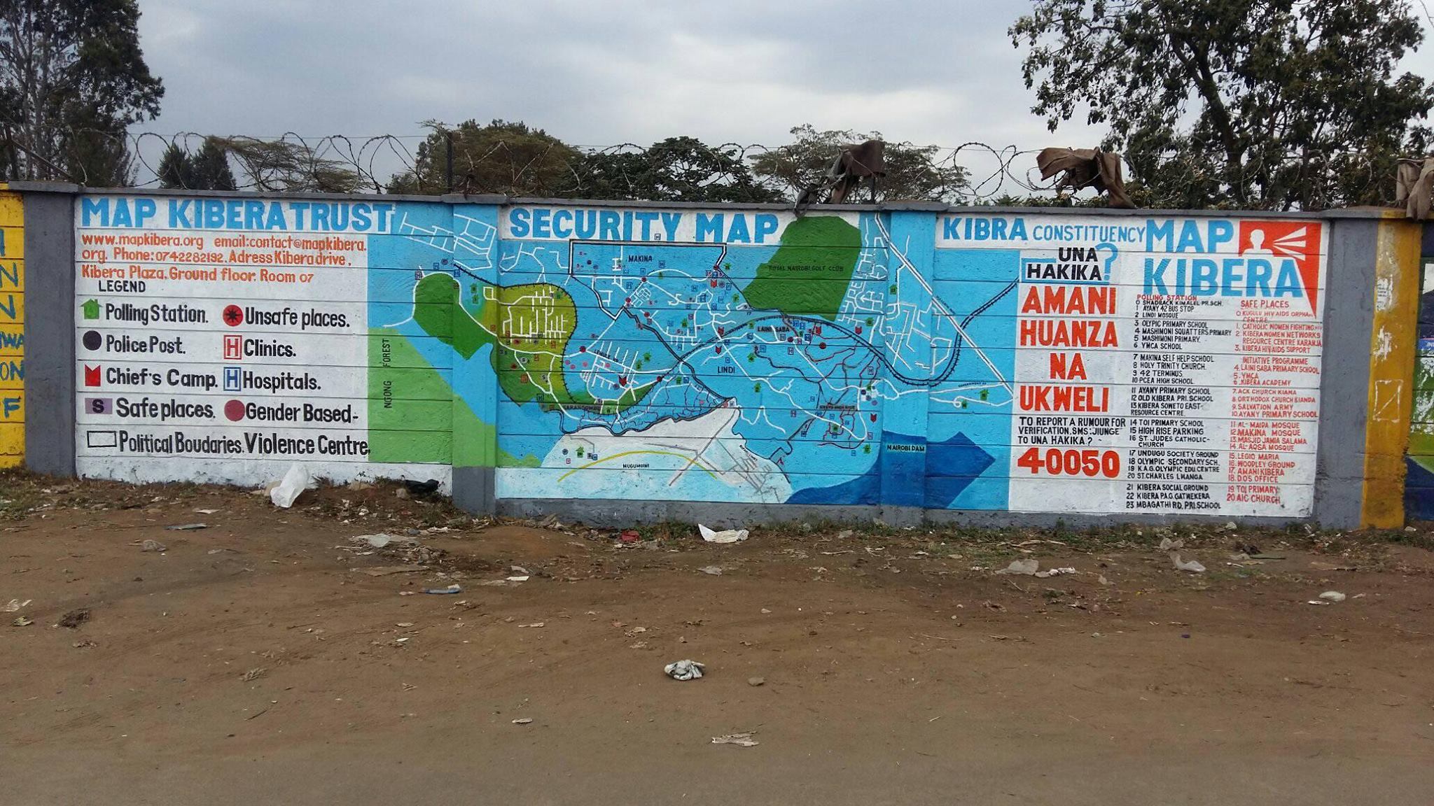
The other copies of the maps were distributed to community members. Read more here. The updated security map was also painted on the wall at a strategic point in Kibera where the community members and visitors would interact with it.

Updated Security map on the wall
During the August 8th election Map Kibera through the Una Hakika project also set up teams on various polling stations to report on the events as they were occurring. This was done through video coverage by the Kibera News Network team. The team was also supposed to report any issues by sending sms to the Una Hakika’s short code 40050.
Citizen reporters trained for the elections
Video Coverage of Elections by KNN
The KNN team produced more than 50 videos for both August 8 elections and the repeat October 26 elections. At least one video went “viral” with more than 13,000 views: Kibera Supports Supreme Court Ruling.
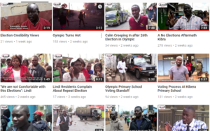
A screenshot of the videos produced by KNN during the election period
Repeat election
On 1st of October 2017 the Supreme Court Of Kenya nullified the August 8th Presidential election. The electoral body of Kenya was thereby asked to organize a fresh presidential election. This meant that our work on election monitoring wasn’t yet finished. So we organized and re-strategized to prepare for the fresh election. The period before the new set date for election saw a lot of demonstrations from the opposition team demanding changes on the electoral body before conducting another election. Kibera News Network documented some of these events, and even did interviews with some of the victims of police brutality after violence erupted immediately after Uhuru Kenyatta was declared the winner of the August 8th election. The IEBC set a new date for the repeat election to be 26th October. We monitored these elections afresh just as we did earlier.
Research
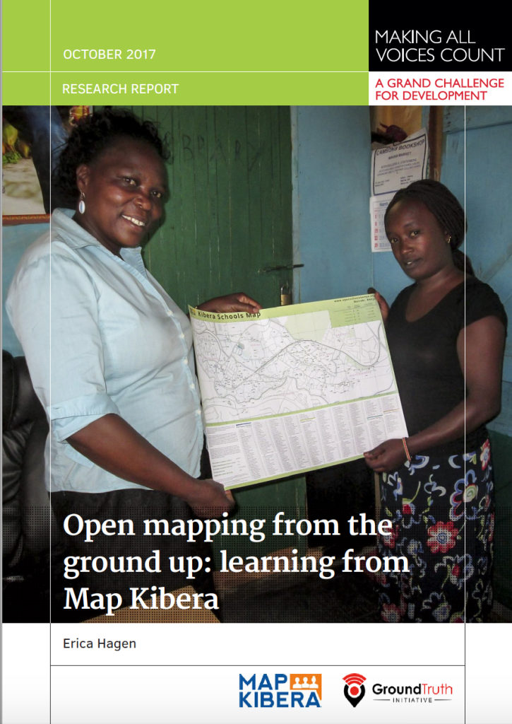 In the same year Erica Hagen, one of the co-founders of Map Kibera, was funded by Making All Voices Count to conduct a research on the impact of the work of Map Kibera in the local community and how the maps are being used by various local organizations, community based organizations, government offices and the community members. Key outcomes were that local officials had used our education maps to reach out to informal schools, build networks and extend resources to these schools. NGOs had also used other maps by Map Kibera to locate resources such as water and sanitation facilities. The research report can be read here.
Sharing, Participating, Collaborating
The year 2017 also saw Map Kibera being recognized and invited to attend various international and national events to share about their work. Some of the meetings were: the High-Level Meeting on Data for Development in Africa held by the Kenya Government and Global Partnership for Sustainable Development Data (GPSDD); Buntwani 2017 organized by Open Institute, Making All Voices Count, Dlad and Data Zetu in Dar es salaam; the Data Pop course at UN Headquarters in Nairobi, and a radio interview at IQRA FM.
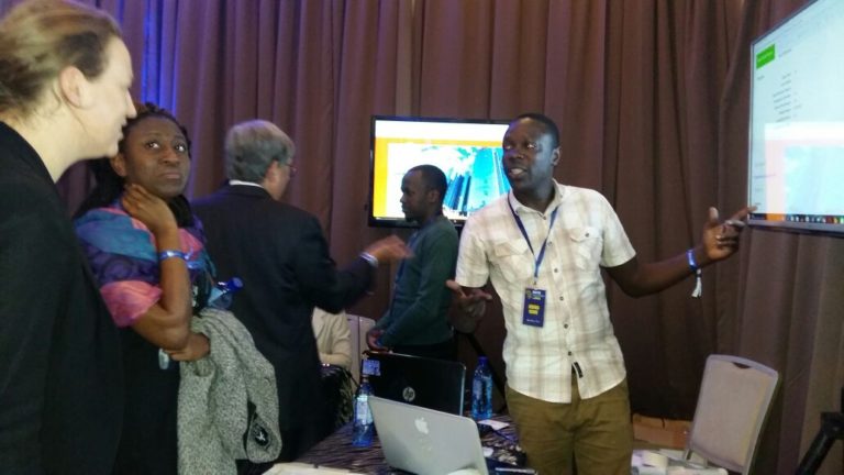
Joshua doing demonstration about Map Kibera and the open schools project at the High level meeting.
 ICT4D
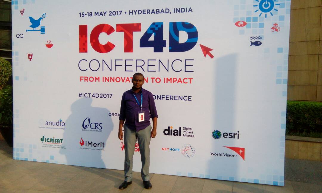
For the second consecutive year Map Kibera has been invited to speak at the ICT4D conference. This year’s conference was held in Hyderabad, India and the theme for the conference was from innovation to impact. Zack Wambua represented the organization at the conference where he shared the impact of the Open Schools Kenya project. Zack also had an opportunity to visit one of the local organization Hyderabad Urban Lab to learn more about the work that they are doing around community participatory mapping in Hyderabad.

Zack Wambua at the ICT4D conference.
 State of the Map (SOTM) AFRICA
This was the first ever SOTM event to be held in Africa, and Map Kibera being one of the oldest users of OpenStreetMap in Africa were invited to share about their work on community mapping, a model that has been borrowed by many groups and organizations that use OSM. Joshua Ogure the project manager of Map Kibera travelled to Kampala, Uganda to represent the organization at the event. Read more here  http://www.mapkibera.org/blog/2017/07/21/my-experience-at-the-first-state-of-the-map-africa/
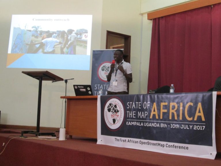
Joshua Presenting Map Kibera at SOTM Africa Kampala
SOTM Tanzania
After the successful SOTM Africa event, OSM teams in Tanzania led by Crowd2Map and Ramani Huria organized SOTM Tanzania. the event took place in Dar Es Salaam. Map Kibera was again called to assist with the planing of the event and also to share about their work during the conference. Zack Wambua travelled to Dar to represent the organization at the conference.

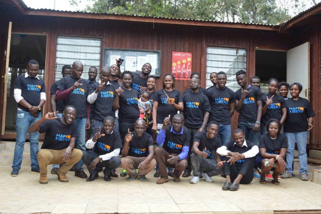
A group photo of all the attendees at SOTM Tanzania
Open Schools Kenya
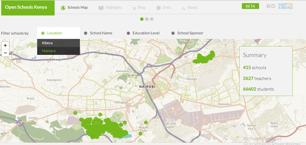
In 2017Â Map Kibera kept up with changes to the Open Schools Kenya data. We along with our interns checked if the schools were still in the same location and if they had moved, we collected coordinates of their new location and updated the details on the site. We were also able to update school populations (for both teachers and students), changes in school management as well as any other co-curriculum activities that are offered in the schools. This was followed by an update to the website, where we added a search by location filter which enables you to view the schools’ data in both Kibera and Mathare, the two locations that we have rolled out the OSK work. Look for more changes and additional locations in OSK in 2018!

A screenshot of the updated Open Schools Kenya website with the new search by location feature
A Daily Diary post by Map Kibera team member, Steve Banner

Steve photographs a school for the Open Schools website
Pictures tell a lot, probably too much for some head teachers in Kibera. They won’t allow anyone to take them in their compound before you explain in detail why you have to take photos, what you intend to do with them and of course how they stand to benefit. Before you pull your digital camera out of your pocket, and press anything, the head teachers, directors, or teachers in charge have a number of questions for you to answer. Forget the journalistic five W and H, theirs probably double or even triple that of journalists.
Me, and my colleague Zack met our first questions at Kicoshep School, where the head teacher wondered why a lot of research was being done in Kibera and what the impact of all these research would be. We took her through the details of the project that entailed collecting new data and coming up with a website that will bring together all the educational facilities in Kibera, and how, not only her school, but all the schools in Kibera stood to benefit from the project outcome. She agreed to help fill the form we had, but then she sent us to their headquarters near Wilson airport to get permission to take photos in her school.
No shutter was going to be pressed at Shofco School for Girls either. Explanation given was that there are strict rules on photo taking in and around the school. Shutter was pressed at Bethel school, but not until after we had spent two hours trying to convince the head teacher, her deputy and other two teachers who had many questions to ask, including some in vernacular language that none of us could understand. They argued that since we as Map Kibera are the ones who will host the website, Map Kibera stood to benefit more than them, citing past examples where organizations collected data and nothing was ever seen or heard of them again. They were keen to know the most immediate benefit that they’ll see – and fell just short of asking to be paid for the information they were to give. But just when we were giving up on them, they gave in to our request.
Otherwise, I was free to slide the exposure of my Canon and turn on my flash sensor where I felt necessary in all other schools, which was both fun and educative in equal measure.
Every moment I had my lens focused on a signpost, school compound or classroom, most of which were in a very poor condition, I felt like I was doing something that the Kenyan government had failed in: giving the schools a voice to speak on the challenges they face. For instance, some school directors pointed out that the government is not very keen in improving education within the slum itself, and is only doing so in the schools that are on the outskirts of the slum. So by me being there documenting the facilities with my camera, I felt that I was indirectly offering a solution to the problems facing school going children in Kibera slums.
So, as I switched off the camera, I felt an inner satisfaction that I had done what many people, government officials included, had failed to do to the schools in Kibera, and when we’ll see improvement in education within Kibera as a result of the online education directory, my happiness will be complete.
 10 years ago Erica Hagen and I were getting ready to start Map Kibera. I read Planet of Slums, was buying laptops on the way to the airport after Crisis Mappers, getting excellent guidance and connections from Ushahidi, and feeling completely overwhelmed. Before we even started, the project was being celebrated in the global media. Heading to Nairobi’s largest slum to make a map. What had we signed up for? I’m looking back on the experience myself now 10 years on, after 6 weeks in a much changed Nairobi.