One year ago, the world was overwhelmed by the Coronavirus (COVID-19) pandemic. This prompted a change in the way things are done and organizations were forced to adapt new ways of coping with the global crisis. Map Kibera therefore was honored to execute a project dubbed Kenya Covid-19 Tracker that involved mapping of COVID-19 data in Kenya-with emphasis on informal settlements i.e. Kibera and Mathare.Â
Map Kibera designed an open, detailed yet simple Ushahidi Deployment map (Kenya Covid-19 tracker) that illustrates the extent of the infections of the corona virus per county, with help from individual donors through Global Giving. The site has tracked resources made available by many different organizations and the government to halt the pandemic in the slum areas of Kibera and Mathare, such as hand wash points, mask and soap giveaways, food distribution and more. The Kenya COVID-19 Tracker also shows news that is directly related to the corona virus sourced from blogs, websites and eye-witness accounts among other various sources. Visit (https://kenyacovid19.ushahidi.io/views/map)
Though the better half of 2020 involved working remotely as opposed to the traditional 9 to 5, map kibera managed to coordinate a great number of events both remotely and physically with strict adherence to the COVID-19 restrictions that were stipulated by the Ministry of Health and the Kenyan Government. Some of these activities include:
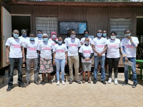
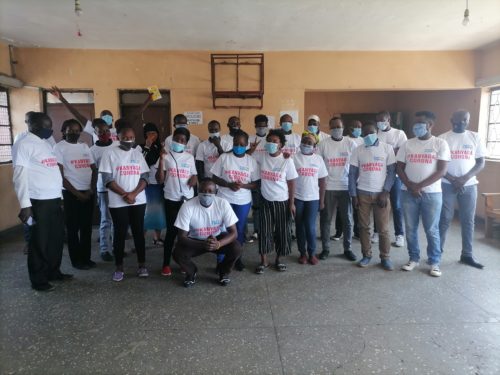
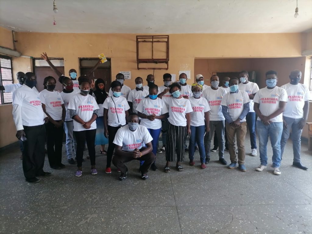
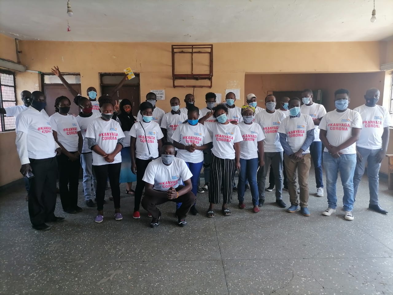
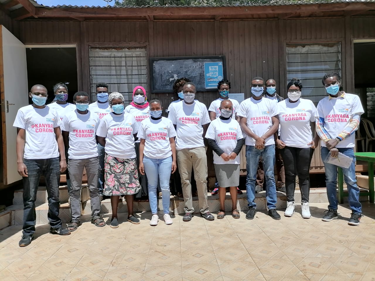
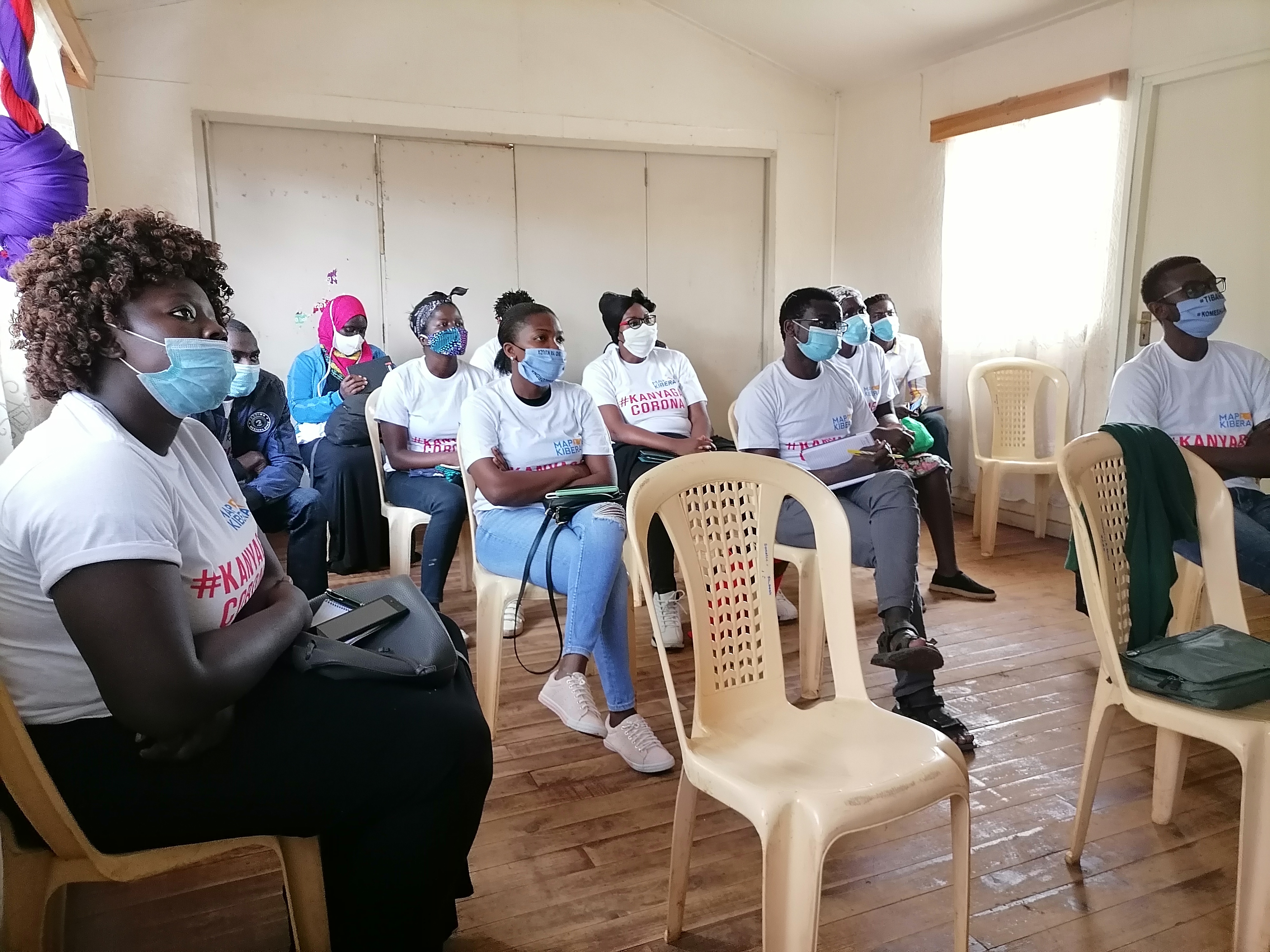
Map Kibera staff together with community volunteers who participated in the project clad in the T-shirts that were distributed to create awareness.
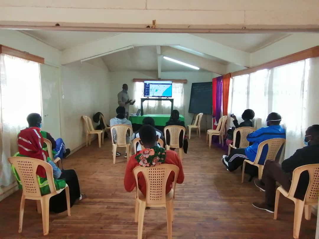
Training of community volunteers.
Thanks to a partnership developed with Ushahidi and FCDO-DAP funding, volunteers and enumerators were trained via webinars and physical meetings that were strictly adherent to the COVID-19 protocols. They used mobile phones to capture data on the ground (Ushahidi Mobile Application) and uploaded the same to the Kenya Covid-19 Tracker. There was also desktop based research that was conducted remotely to report also on the-news, cases of infection, death and recoveries. Additionally, Map Kibera staff were tasked with quality assurance, this ensured that data added on the Kenya Covid-19 Tracker were accurate and timely and as truthful as possible to avoid cases of misinformation and rumor mongering.
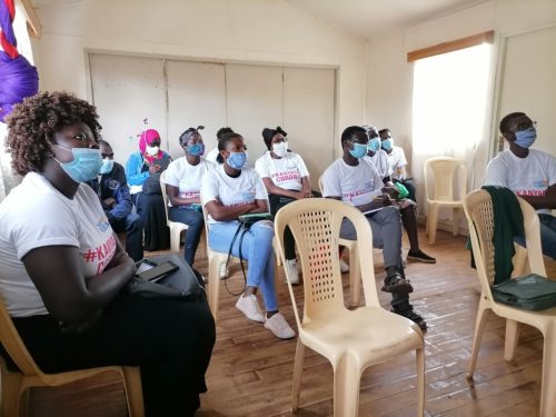
Community volunteers from Kibera during one of the training sessions at Mchanganyiko in Kibera.
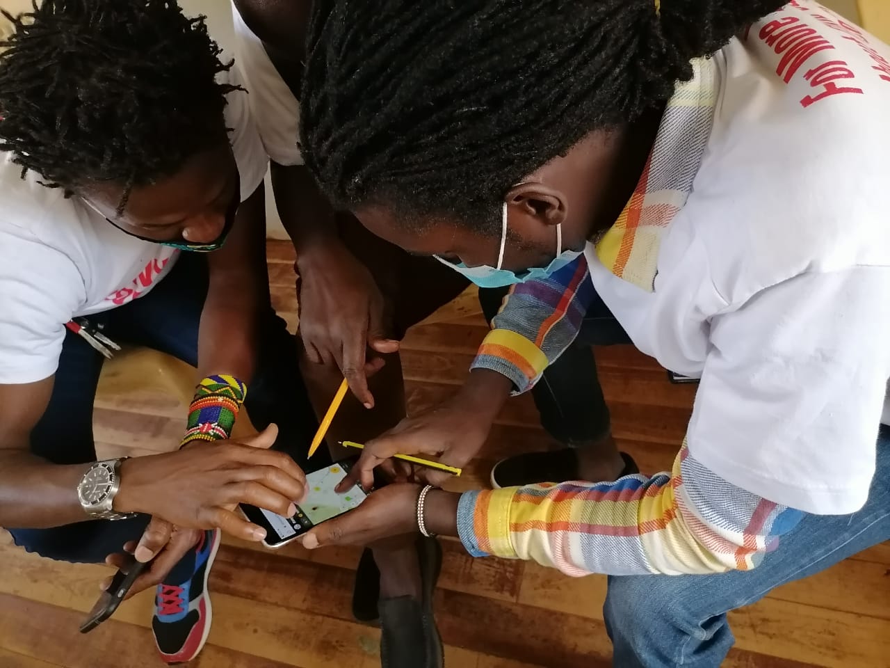
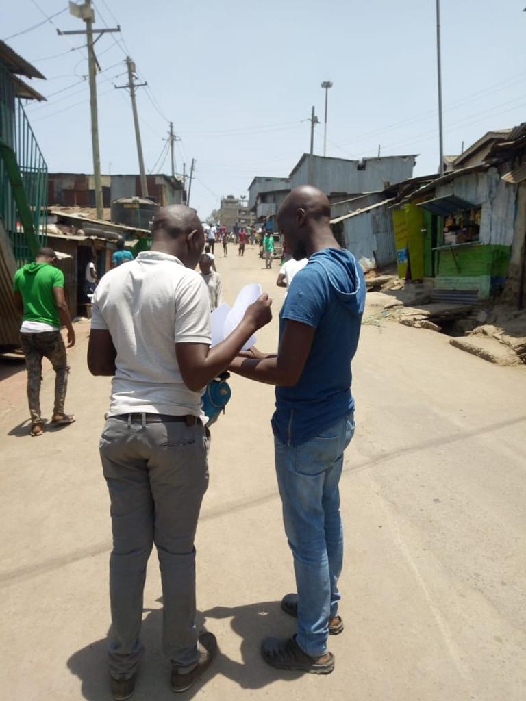
Field mapping and reporting
Since mapping and data collection is labour intensive, Map Kibera had to recruit data enumerators and volunteers from all the villages of both Kibera and Mathare to assist in the mapping of COVID-19 resources and also report on the news. This involved mapping out of hand washing stations that were donated by various organizations, food distribution conducted by various charitable organizations and also in general; the distribution of various items that ranged from face masks, hand sanitizers and Personal Protective Equipment (PPEs) that were donated to various health facilities to assist in the fight against the spread of COVID-19.
https://kenyacovid19.ushahidi.io/views/map
Updates and Follow up
Furthermore, there was also need to make regular updates due to the emerging issues in the wake of the coronavirus pandemic. Towards the end of the year 2020, certain trends were emerging that needed to be captured in the story map. For instance food donations were gradually decreasing as the government initiated economic recovery plans and this move so many people resume work. Consequently as the situation normalized, people also started neglecting some of the protocols and this resulted in the neglect of hand washing stations-which were in most cases taken by individuals for domestic use.
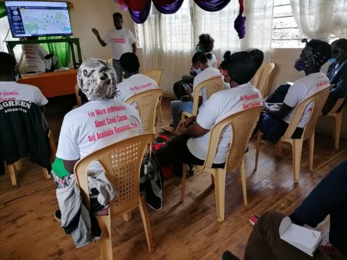
Map Kibera’s Zack Wambua conducting a training session on the Kenya covid-19 tracker project.
 Mural on the Wall
Map Kibera went a step further to draw murals on public spaces in both Kibera and Mathare. The purpose of the murals was to create public awareness and also create an offline platform for the public to interact with the data on the Ushahidi Deployment map (kenya covid-19 tracker). This has proved to be a useful approach because it ensures transparency and data sharing to the benefit of the community at hand-in this case Mathare & Kibera.
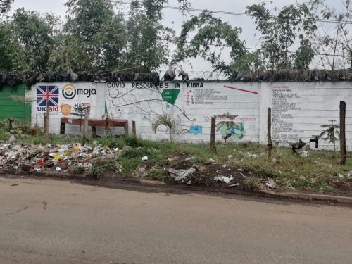
Kibera Resources mural along Kibera Drive.
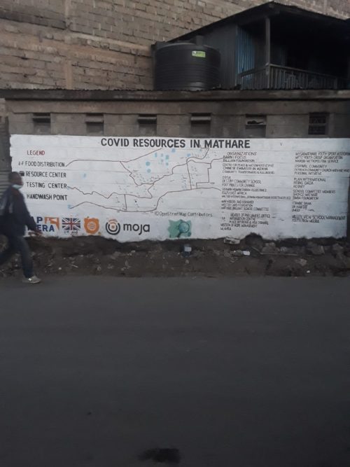
A mural in Mathare showing the Covid-19 Resources
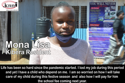
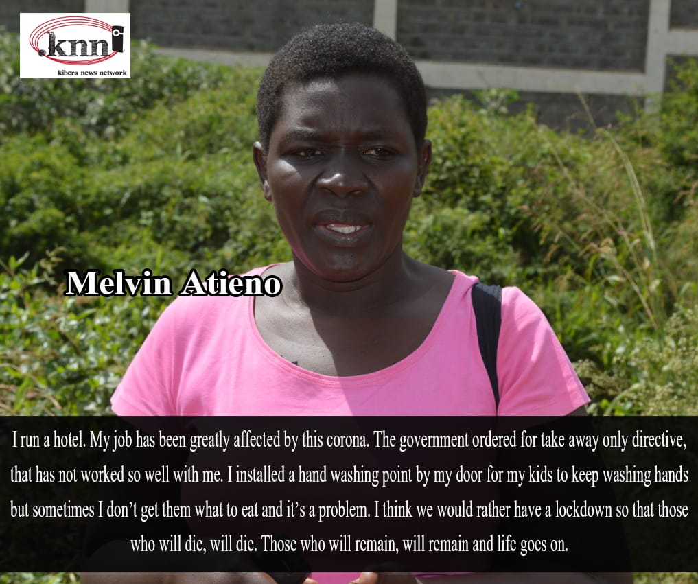
Humans of Kibera & Mathare
Kibera News Network (KNN) also started an initiative called Humans of Kibera and Mathare. In this case random people from both locations were interviewed and they shared their ordeal during the Coronavirus pandemic and how they made it through the tough season that was characterized by lockdowns and curfews.
Internet provision from Moja WiFi
Map Kibera also partnered with Moja WiFi to provide internet services at specific public points in both Kibera and Mathare slums. Since most of the work had to be online. Furthermore Moja wifi showed some of the video clips from KNN on their online platform in a bid to further share with the public regarding covid-19 experiences and eye witness stories.
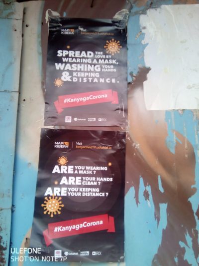
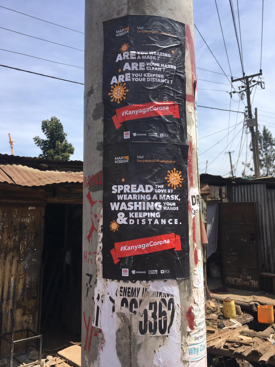
Posters were also circulated to the residents of Kibera and Mathare to create awareness.
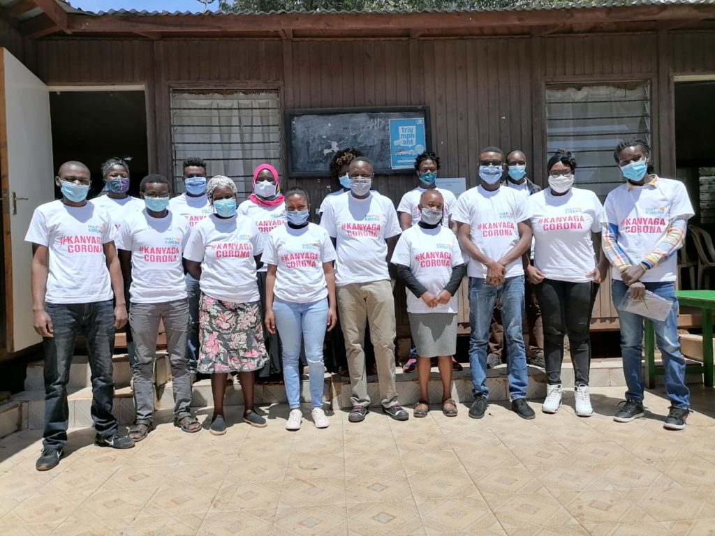
 The team from Mathare were equally excited for being involved in the project.
ImpactÂ
The Kenya COVID-19 Tracker had a great impact on the residents of Kibera and Mathare as well. People had the chance to interact with the data through the wall murals and the online platform. “…We know that information is power and the ability to access it is even more powerful…†as stated by Moses Omondi, a resident of Kibera and also team leader for Adopt a family, an NGO that has used the data provided by the Kenya COVID-19 Tracker deployment map. He further acknowledged that the map offered direction in terms of where to source for different services, how to also access different resources like food distribution and donations with regards to the COVID-19 challenges in Kibera. The deployment map was created in a way that it can be used for various purposes like for health reasons, logistical and also general information.Â
In conclusion, the Kenya Covid-19 Tracker Project was a success and the extensive data that was generated is actually free to all interested parties and can prove resourceful with regards to how informal settlements are equipped in times of distress; for this case a disease outbreak. This open data can be used to address an occurrence of the same nature and magnitude and with the insights provided, the necessary measures can be applied to achieve the best results in governance and service provision.
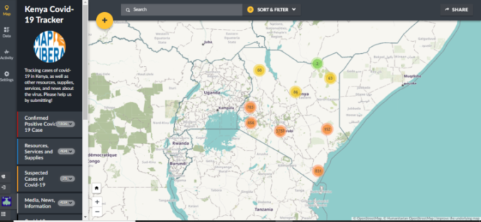
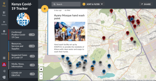
The Kenya covid tracker main page, with map showing distribution of cases, resources and other posts
2020 has been a unique year owing to the fact that the whole world was brought to a stand-still by a global pandemic. Kibera and other informal settlements of Nairobi weren’t spared either. Most of the Kibera residents work as casual labourers and due to the regulations set up by the government, the majority of the residents lost their jobs while some had to shut down their business. This left most of them having to rely on well wishers for any form of support.
In response to this, many organizations came up with initiatives to support the community; this varied from sensitization activities, food and soap distributions, setting up hand wash points and other relevant resources. Map Kibera, having worked with these organizations in other events and activities, partnered with them to:
- Map out their activities and post them on the Ushahidi-based Kenya Covid-19 tracker; this included training them on how to post their work and offering support in posting them where necessary.
- Directly support the programmes they were implementing on the ground.
A group photo with representatives of different organizations in Mathare.
A group photo with representatives of different organizations in Kiber
Mid this year Map Kibera was awarded the 2020 Rapid response Micro-grant funds by Humanitarian OpenStreetMap Team (HOT) to support our Ushahidi deployment. We created the site for tracking Covid-19 cases, resources and news related to Covid-19 —primarily in Kibera as well as the other informal settlements of Nairobi, but also other parts of country. The goal was to keep this information together in one easy place, allowing people to see what is going on around them that might be relevant to them. This was also to aid in our efforts to keep Kibera, one of the most vulnerable communities to illness, healthy during this pandemic.Â
Joshua doing a live demo of how the Kenya Covid Tracker platform works

Joshua introducing the project to the team from different organizations in Kibera

Some of the participants testing how to add posts on the Ushahidi platform using their mobile phones.
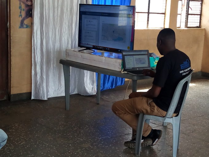
The team had already started working remotely, and therefore made use of the online tools for accomplishing the mapping tasks involved in the project. The team used tools like Maps.Me, healthsites.io, and of course OpenStreetMap to work on all the mapping tasks that were agreed upon. The initial training was conducted in form of webinars through Zoom and Google Meet; this was because of government directives on safe distancing to prevent the spread of the coronavirus. As the tools mentioned above suggest, the goals of the mapping activity were the following:
- To train community volunteers on how to add and edit information remotely on OpenStreetMap
- To ensure timely and accurate health data on OpenStreetMap
- To improve coverage of maps on health in the country (especially on informal-settlements)
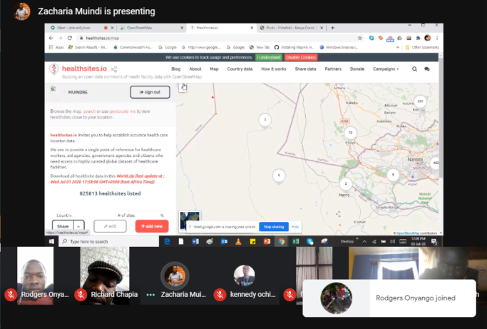
Screenshot of one of the webinars we hosted
Â
Amidst the pandemic, one unique thing that has prevailed is how resilient we can be as humans. In Kibera, our news team KNN captured a story of a lady who used donations given to her to start a business, hence having a more sustainable means of supporting her family.All these various activities have enabled the organization to achieve new milestones with regards to Open Data. Since map data is dynamic, the Map Kibera team has been able to create new data, and update already existing data. One way has been through data import; around June, we worked closely with UN Habitat by assisting them to mobilize youths from Kibera who we have engaged previously in some of our mapping activities. The exercise saw the team collect basic information about specific features in Kibera relevant to the Covid pandemic. After the exercise, we uploaded this open data into OSM. Considering Map Kibera has done extensive mapping in the area, we needed to ensure there were no duplicates, and if the feature had already been mapped, to update the feature with the new data. The data import process has been documented on wiki. So far we have managed to add and update over 1400 features on OSM in Kibera and Mathare. Later on UN Habitat shared more data with us to import, this saw us cover new areas such as Kawangware and Kisumu (the import for the two new locations is still ongoing).

Our team members from Mathare while on the field to cross-check and verify the data that was imported and checking for any extra information that was not captured.
We also have recently trained more community ambassadors on the use of various mapping platforms that are freely available and accessible to the public. This wouldn’t be easy to achieve without the financial and moral support from HOT and all the parties that were involved in the Micro-grant Program.
Please help Map Kibera’s Covid-19 efforts by donating now via Global Giving! 
As cases of coronavirus continue to mount in Kenya, Map Kibera has launched the Kenya Covid-19 Tracker. The tracker uses Ushahidi’s platform to track cases throughout the country, related news, and key initiatives underway to help citizens. Map Kibera has details on many Kibera-related resources, and is working with other organizations to include country-wide efforts to help prevent the spread of the virus and address hardships of the social restrictions.Â
 Meanwhile, the Kibera News Network team has several initiatives underway:
- Covering the pandemic’s effects on video, and how it is affecting people in Kibera;
- Sharing out information and dispelling rumors via their WhatsApp broadcast group (to join, save +254794590404 to your phone and type us your name). Residents are asking questions to KNN about the virus, and KNN shares out daily updates on case tallies and latest government initiatives, health advice, resources, etc.
- A new Humans of Kibera series with opinions and quotes from people about Covid.

Using the Covid Tracker, Map Kibera and the KNN team are mapping not only new Covid-19 cases daily, but also work that organizations and individuals throughout the country are doing to try to help during this outbreak, like distributing food and face masks, setting up hand-washing stations, and more. Initiative leaders can also submit their own posts about what they are doing. Map Kibera is additionally mapping news items related to the virus, like articles from major new sources and tweets and social media. We are verifying all posts.
We want organizations to share their own work too using our tracker. Several Kenyan organizations are already using it to map their own work. Click here to share a resource with us!
We’ve set up a Global Giving fundraising page for these efforts. Please check it out here and support us if you can!