by: Steve Banner May 7th, 2024 comments:
Despite previous efforts to install lights in Kibera, some through the Adopt-A-Light program initially headed by Nairobi women representative Esther Passaris, and others through the Nairobi County government, there have still been reports of a rise in criminal activities within Nairobi’s informal settlements such as Kibera, Mathare, Mukuru among others.
Previous programs had overlooked the need to actively engage the community in the process of installing lights in our informal settlements, in the quest to achieve the goal of having proper security measures that can protect residents within the slums.
Other challenges that have faced those other programs include frequent blackouts witnessed in slums as a result of tampering with electricity lines, transformers, and power cables.
It was for this reason that Map Kibera, Kibera Town Centre, and LIF came together to conduct a ‘Measuring Lights Impact’ survey within Kibera slums, to get the much-needed input and community engagement ahead of solar-powered street lights installments, not just in the streets of Kibera, but also deep inside the residentials.
The survey has been conducted in Gatwekera Village, Kianda Village, Soweto Village, and parts of Makina Village.

Feedback has been good so far, with many residents welcoming the idea of having solar security lights as opposed to electric lights.
Nicholas Ogutu, a Kibera resident who lives in Soweto West village, and works as a construction expert, says his work sometimes involves traveling long distances, and most of the time he has to leave the house in the early morning hours when it is still dark.
“With the lights having been installed in the village, I will not have to worry about being attacked by criminals when I happen to leave while it is still dark outside, and that will have improved my work and by extension, my life” he adds.
Irara, who lives in Kianda village and is waiting to join college, hopes that the lights are installed as soon as possible, to help her while leaving or coming back from her early morning or late night classes in case she will have any, once she joins college.
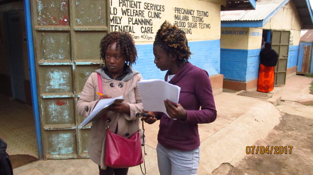
The survey was conducted by 10 youths from Kibera, who walked from one household or business to the other, with a set of questions that helped to determine the state of security in each village and the location of each light within that said village.

As the project proceeds, we are looking forward to getting more feedback from the residents in the post-installment survey once the lights have been installed in all the designated areas.
by: admin September 4th, 2017 comments:
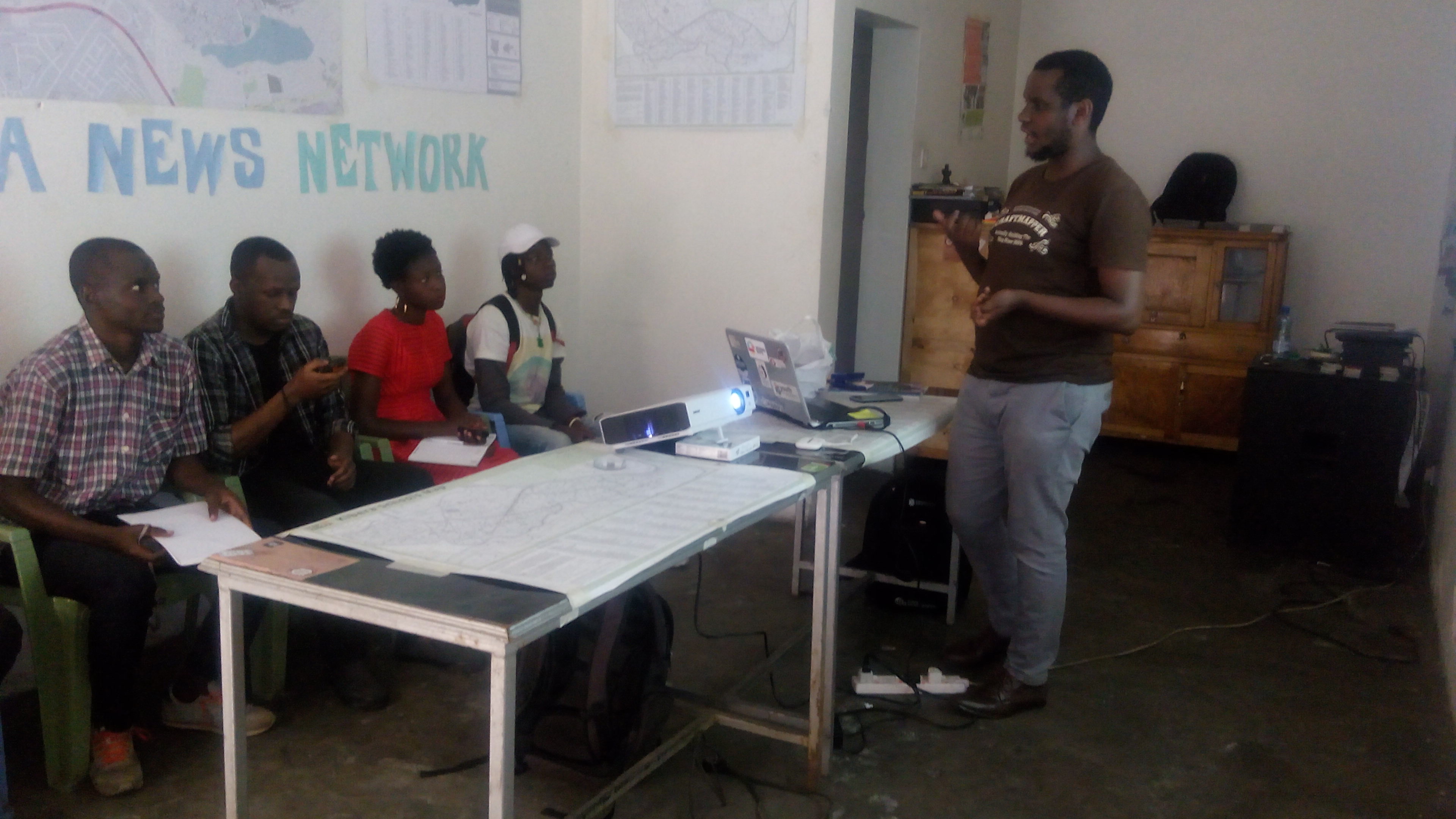
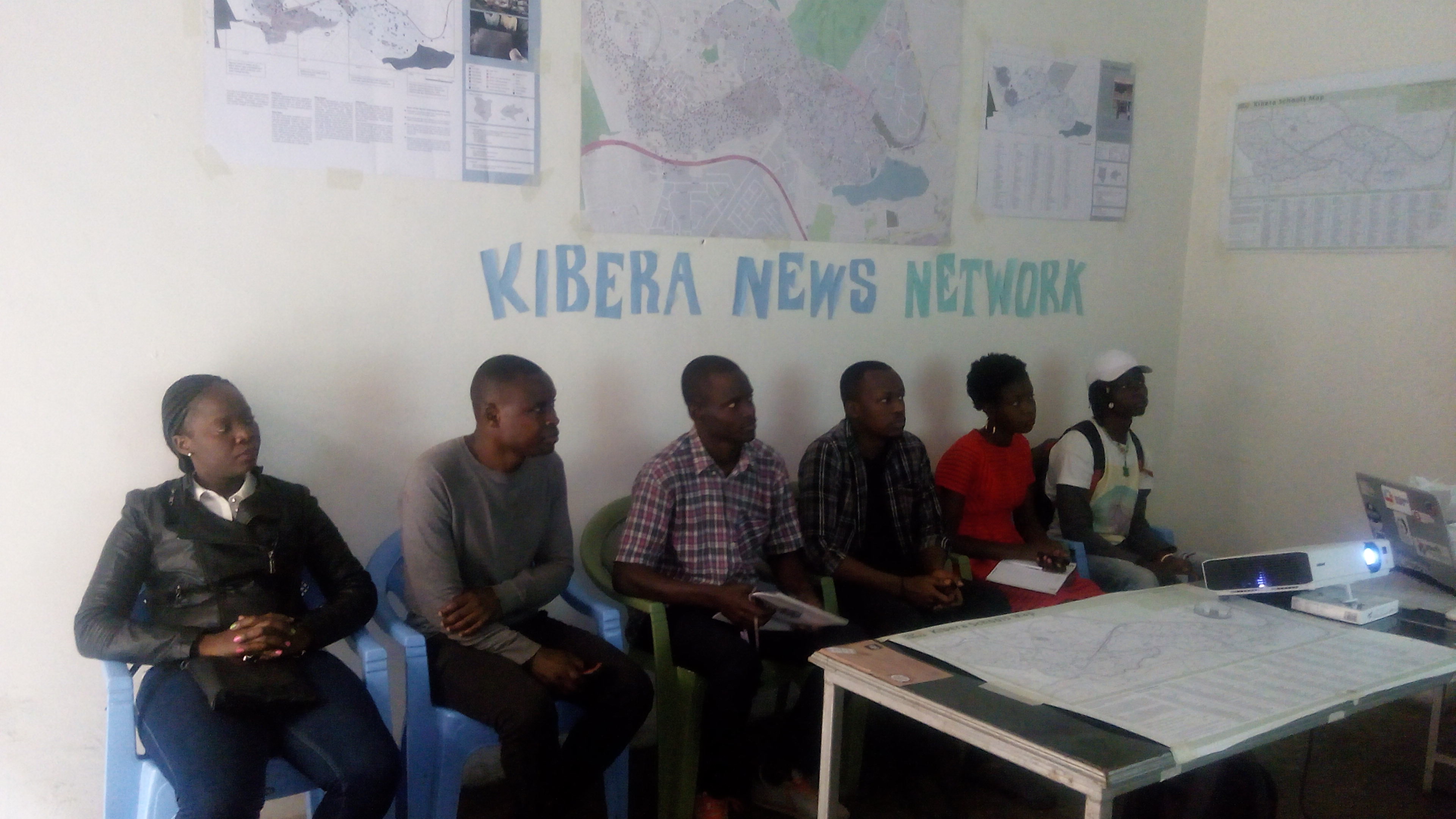
As part of the internship we are having at Map Kibera Trust under the YouthMappers programme, one of the activities that we were involved in was the Security Mapping project in the months of June and July.  The project was aimed at highlighting the areas of concern within the region owing to the fact that it was an electioneering period in the country, and there was a need to update the security map since the last time it was updated and used was during the 2013 elections. Some of the features that we were going to map were safe and unsafe areas, street lights, health centers and police posts within the area.

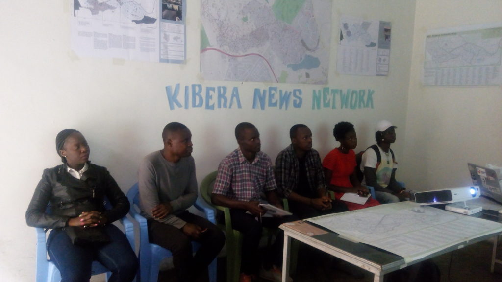
Prior to the mapping exercise, we had a training session at our offices under the leadership of Zacharia Muindi, our Mapping coordinator and team leader. In the training we were trained on how to use the GPS in collecting data and other tools like the questionnaire and camera. We grouped in twos, with local volunteers who had adequate knowledge of Kibera. The training went on well and we had a few practicals before heading to the field, this was to ensure that the tools were working and everyone was on the same page.

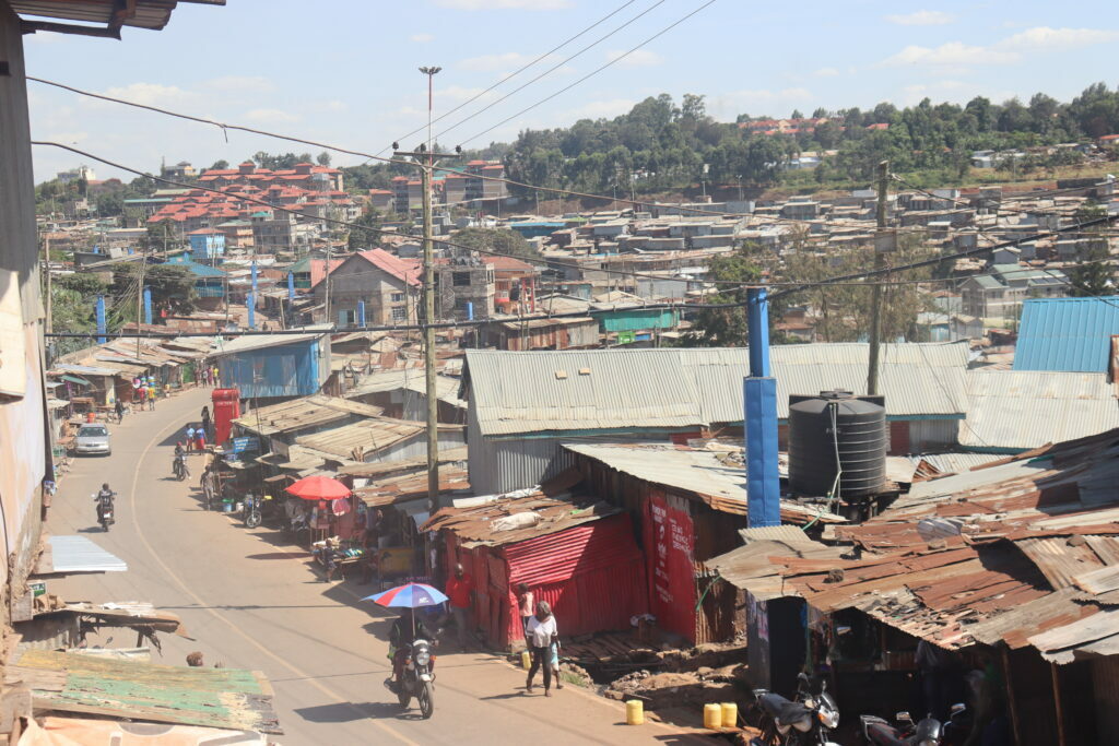
The mapping experience was interesting and challenging at the same time. The interesting bit of it included working with the locals and getting to know the vast expanse of Kibera, which was actually intriguing. We also noticed that some areas were unique and different in terms of development; areas like Nyayo Highrise and Fort Jesus had modern housing and well planned infrastructure. On the same note we also realized other areas that were still lagging behind in terms of development like Mashimoni and Lindi Ward. However, the mapping exercise was also challenging-moving around the area was physically demanding. Despite of the challenges we all managed to capture all the points (data) that we intended to collect.
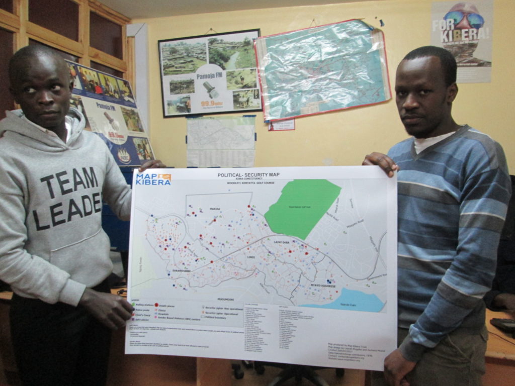
From there we computed the data we collected using OSM editing tool Java script OpenStreetMap (JOSM) and uploading the data into OSM. What followed was designing of the Security Map and printing them out for distribution. The distribution exercise went on well and the maps were well received by most of our recipients such the D.C, AP inspector general, local NGOs that are working around peace initiatives in Kibera and the local community members. Through the interactions with the map and explanations from the team they were able to interpret the data very well and they acknowledged that the map is going of great help to the work that they are involved with.
This is a guest blog post by Peter Agenga and Phylister Mutinda, interns with Map Kibera from the Youth Mappers chapter of the University of Nairobi.
by: Douglas Namale April 10th, 2013 comments:
Map Kibera Trust has completed painting a security map on two walls in Kibera as a community outreach program.
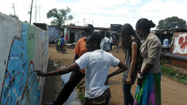
Wall painting played a big role in providing key security information during the just concluded general election; particularly to visitors and even the locals who don’t know about certain political hotspots, and unsecure places in Kibera.
 The state of the identified wall. It was dirty full of political aspirants’ posters. The first duty was to clean it up.
The exercise was coordinated by Millicent Achieng and Douglas Namale; who worked together with Mappers and other stakeholders. The stakeholders were the Provincial Administration, District Peace Committee (DPC), Labour Youth Group, Youth Reform, and Community Artists, opinion leaders, youth leaders and political leaders and Map Kibera Trust staff.
The youth groups helped to identify the walls and are providing security to the painted walls protecting them from political posters and other interests. Â We had four consultative meetings with stakeholders to identify the map to be painted on the wall from the five thematic maps developed by MKT. Â The stakeholders settled on the security map, because it coincided with the general elections expected to take place in March 4th 2013.
Labour Youth group and Youth Reform played a key role to secure the wall where the map was to be painted. They also volunteered to provide security during and after painting. Labour youth group also helped us get the best artist who painted the map on the wall. It’s worth mentioning that the artist is also a Kibera youth. The artist also volunteered to help MKT secure walls in other parts of Kibera to paint the same map.
Coordination between the Artist, Labour Youth Group, Youth Reform and MKT office was cordial. They coordinated with Mappers well, to facilitate the exercise. The artist’s flexibility made it possible for many adjustments on the map during the exercise, before the final map was accepted.
 Millicent, Diana and Douglas clearing the identified wall
Immediately the wall painting started, we witnessed crowds gathering next to the venue and watched the artist as he painted. Village and religious leaders congratulated the work and pointed at some areas we had identified as black spots which they confirmed to be so.
DPCs and the Provincial Administration also confirmed the wall image as a good idea. School children stood and watched the map, and some teachers are now referring to the map in their lessons. We have also received visitors in the office, who have confirmed to have been directed by the map painted on the wall.
Challenges
Wall identification was challenging. We used different methods which failed before we settled on the Youth groups.   City council of Nairobi demanded Ksh. 9000 as advertisement fees and other unexplained fees with other draconian procedures which made it impossible to paint the wall. Although the City council demanded the advertisement fee, they could not guarantee security of the painted wall. It’s worth mentioning that the city council does not have the wall, the walls belongs to private developers, who are denied jurisdiction to accept anybody to paint or draw anything without the City council’s consent.
 A complete painted along Kibera drive.
Apart from the city council melee, some of the walls painted were not wide enough to accommodate the map contents correctly; the artist had to squeeze the contents to fit. Another problem was that some of the data on the map was obsolete because it was about one and half years old. This was attributed to the extended time spent to search for the walls. The shorter period allocated to planning also played a role to this since the data Mappers had collected did not feature on the map which was painted on the wall.
Despite all this, the two walls painted has increased Map Kibera Trust’s contents visibility offline by a huge margin, particularly the general public who are not members of organized groups like NGOs, CBOs and Youth groups. The visibility offline can increase if more walls can be identified and painted in other villages in Kibera, particularly along busy streets and paths.