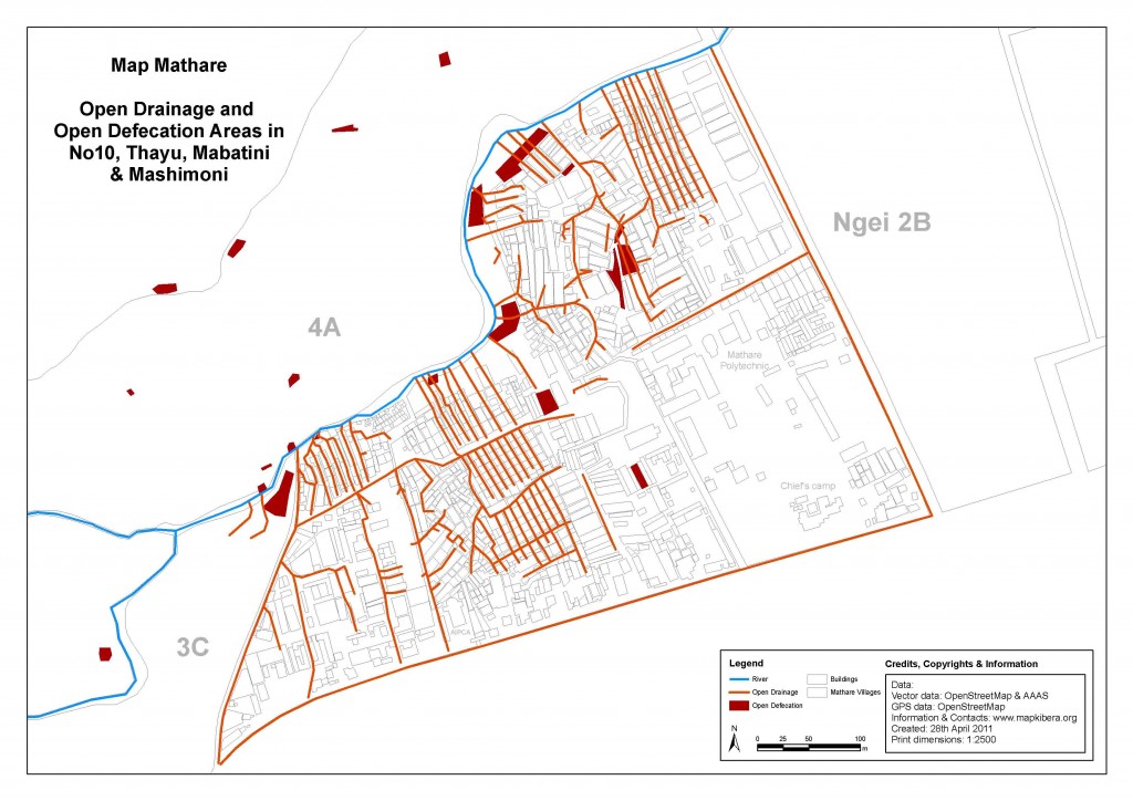
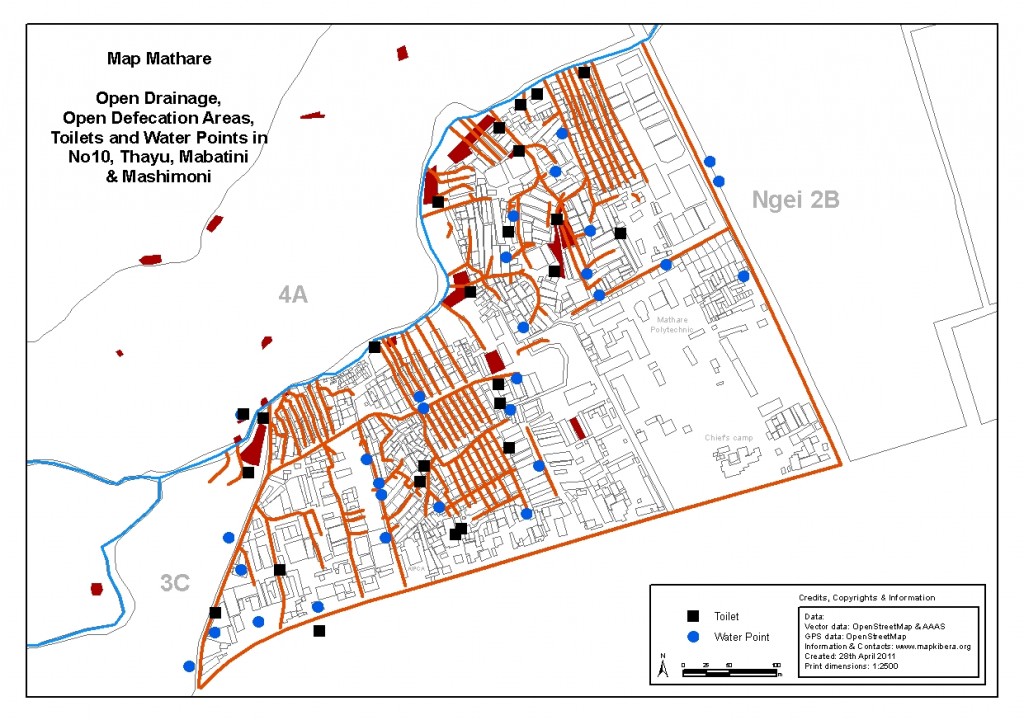
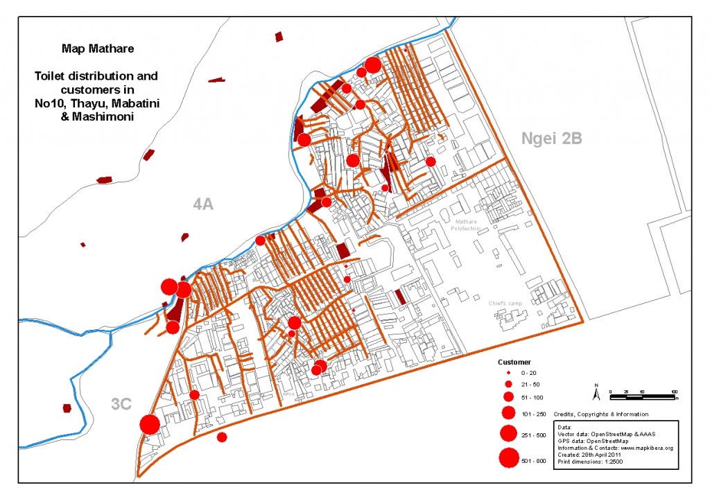
Our biggest focus during this pilot project in Mathare was on four villages: Mathare No10, Thayu, Mabatini, and Mashimoni. This is because our local partner (Community Cleaning Services) operates in the area and also because we wanted to test our capacity – figuring out how much can be done in the limited amount of time.
Apart from mapping toilets, water points and open defecation in the area; building extraction from the satellite imagery; and through ground truthing building classification, we also mapped most of the open drainage lines.
These are some of the results:
- All four villages cover 209848 m2 out of which open defecation areas cover 4014 m2 or 2%.
- We collected 8.35 kilometers of open drainage lines in the area.
- There are 25 points where toilets are located, altogether with 95 units (toilets). These are all in, or in the immediate vicinity of, the four villages, and most of them are public toilets.
- These toilets serve almost 4000 users.
- Hand washing facilities and towel bins are almost non-existent.
- There are 30 water points in the area, all operational, and mostly privately owned.
More of the same on Mapping: No Big Deal


