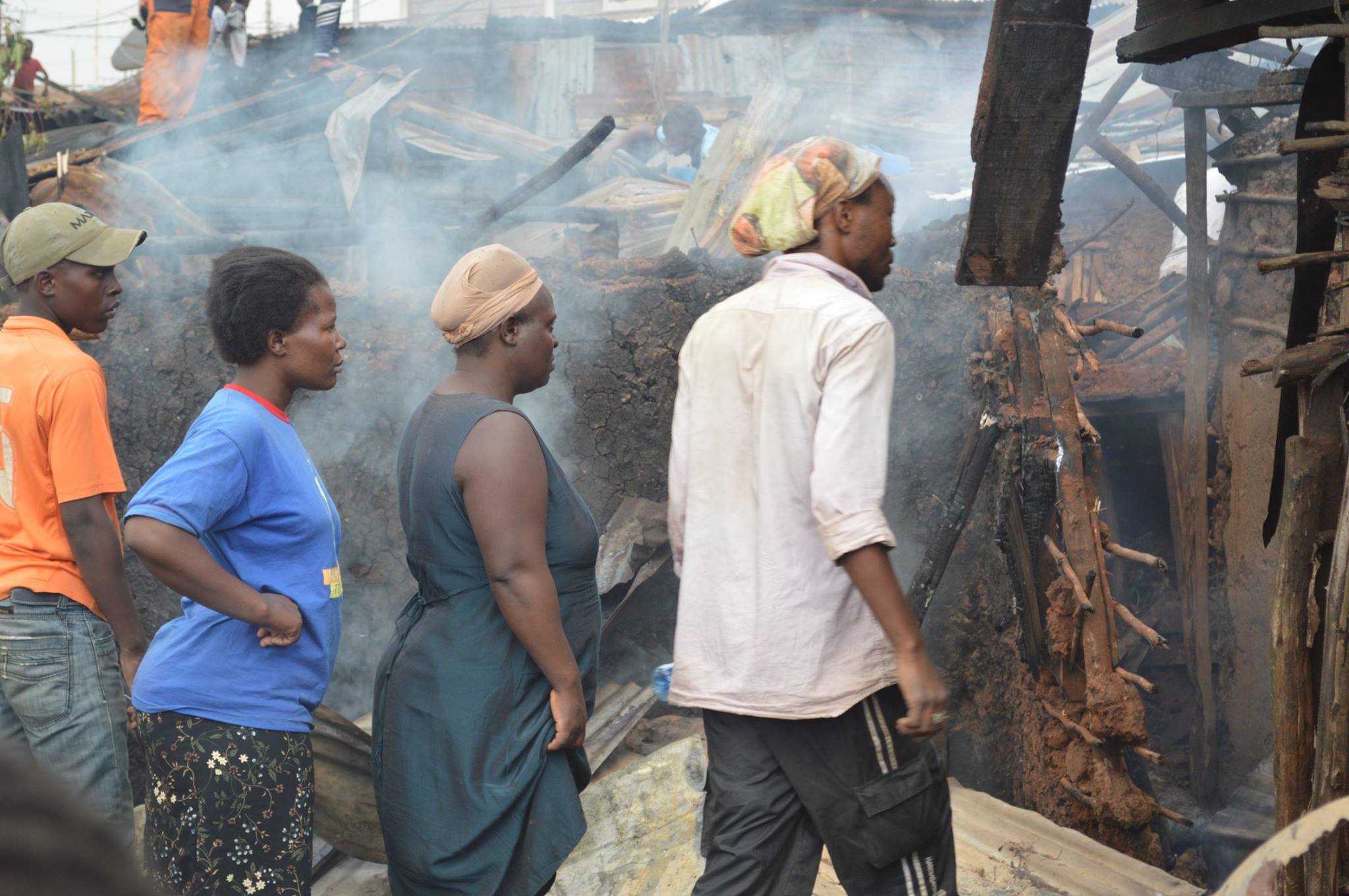
On 17th March fire has erupted, destroying properties in Lindi near Mashimoni Squaters School. Around thirty families were left homeless.
Some victims viewing at their burnt houses
Recently other two fire incidents were reported in Gatwekera and Laini Saba respectively. Fire incidents are usually reported about three per month in Kibera. The main causes of fire range from electricity faults to gas explosions, to domestic incidents or in some cases has been alleged they could be caused deliberately by people with hidden motives. In this particular Lindi case, the fire is said to have been caused by an electricity fault.
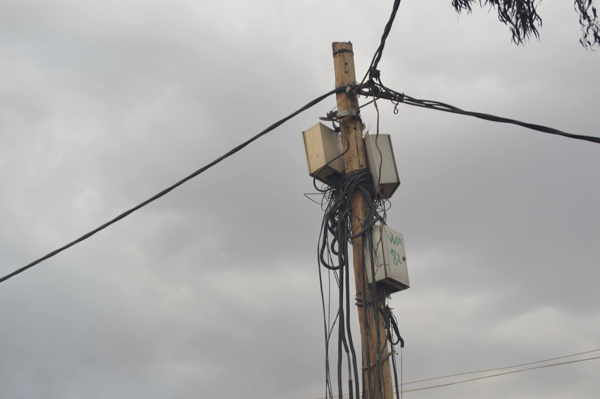
The electricity pole in the middle of the burnt houses
After the resonance of the KNN photos on Social Media, the office of Kibra MP Ken Okoth contacted KNN and promised some assistance to the affected families:
“Tomorrow 18th March 2017, the office of Kibra Member of Parliament Hon. Kenneth Okoth will donate Blankets and Mattresses to victims of Lindi Ward. The office also asked Mashimoni Squarters Primary to accommodate the affected families tonight, and till the day affected families will structure their homes.â€
The day after, the KNN team went back to witness the aftermath of the fire and talked with some of the victims. “The fire started when I was outside and since I have a broken leg, I couldn’t run in and save anything. I really appreciate that the MP office have brought us some blankets and mattresses, but only if they could help us rebuild out houses, that would be great, because now finding a house in Kibera is very difficult. In my condition I can’t walk to search for a new house and I have two childrenâ€, said Marion Ashioya.
During the distribution of the mattresses and the blankets, George Otieno, representative of the Constituency Emergency and Response Affairs, stated:  “We have helped over thirty people, we brought them some blankets and mattresses so they can find something to start with. I would like to ask the County Government to ensure that each Sub-county has its own fire engine that can help in such cases. However, the landlords buildings here must also leave enough space that can enable fire engine to penetrate, save lives and properties.â€
The Mashimoni Squartes Primary has hosted fifteen people since the first night, while the other affected families are hosted by neighbours as they work to rebuild their own houses.
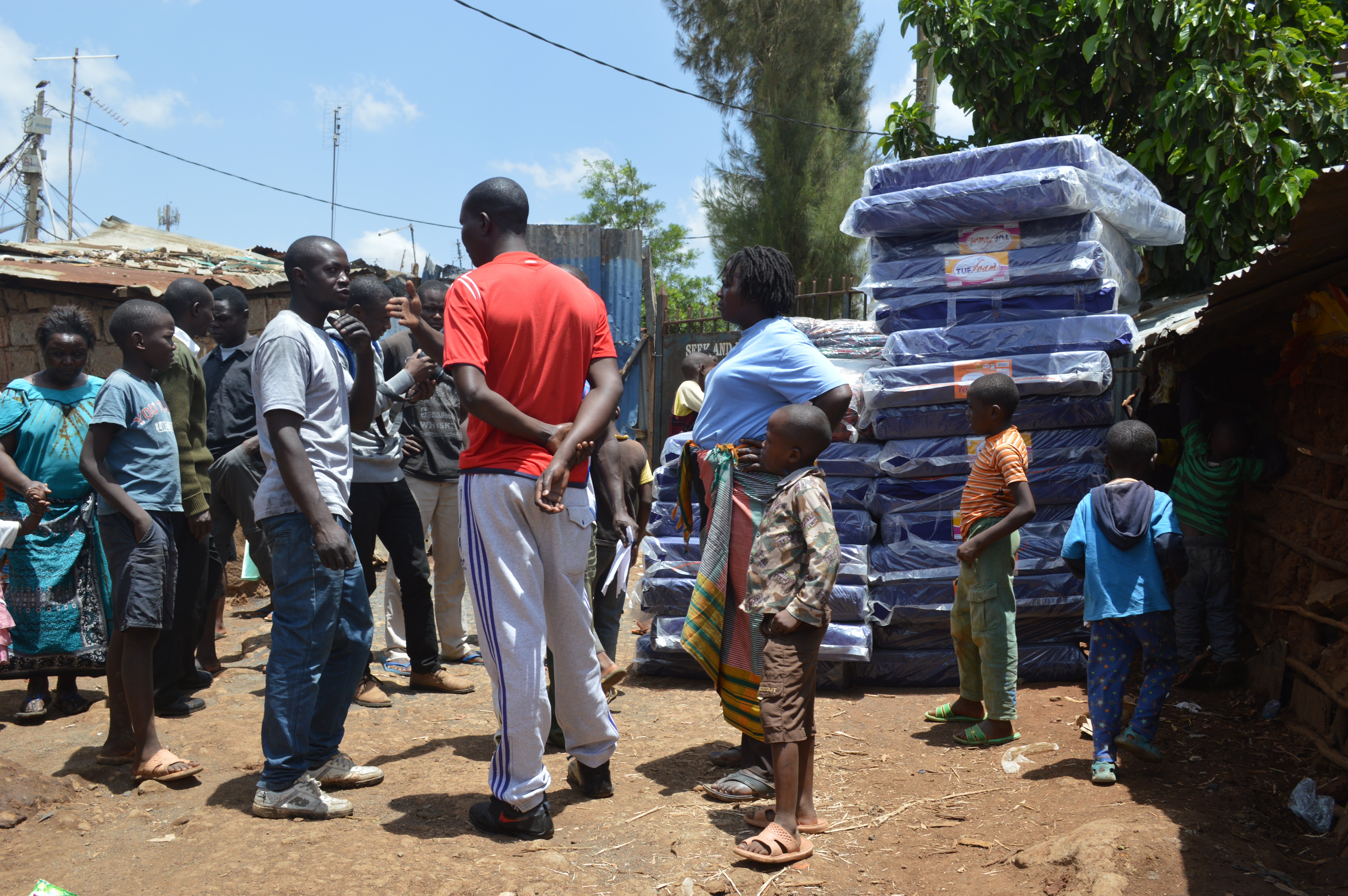
At the distribution of the blankets and matresses
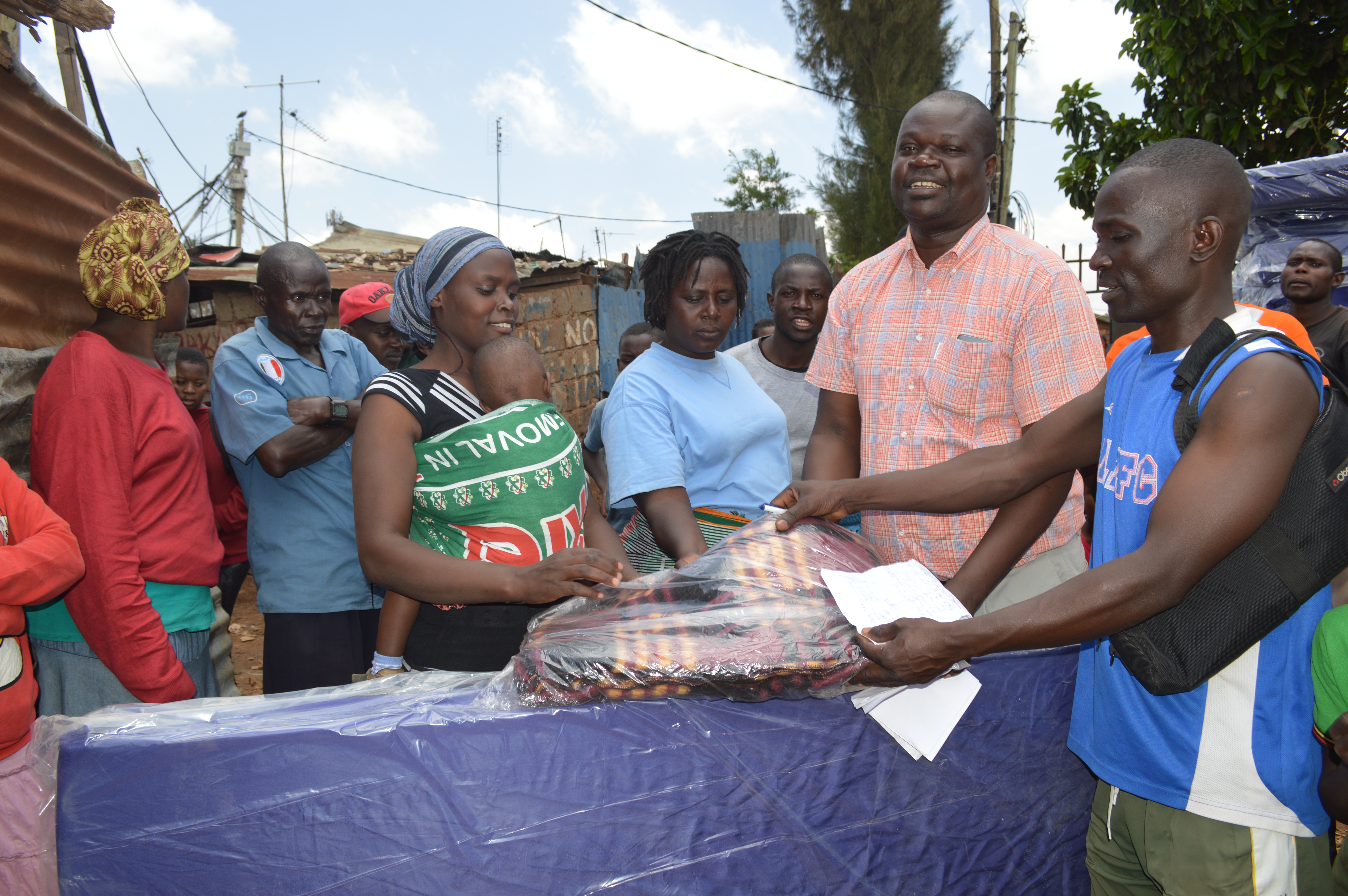
George Otieno from the office of MP leads the distribution process
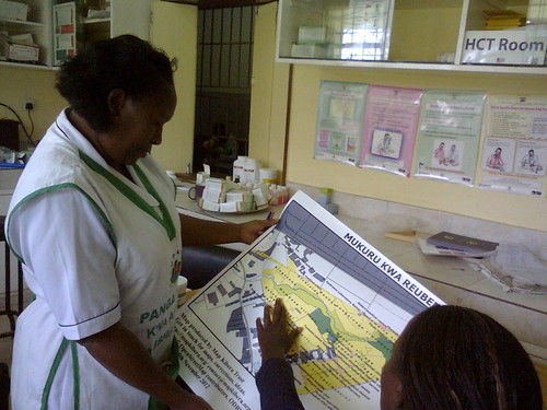
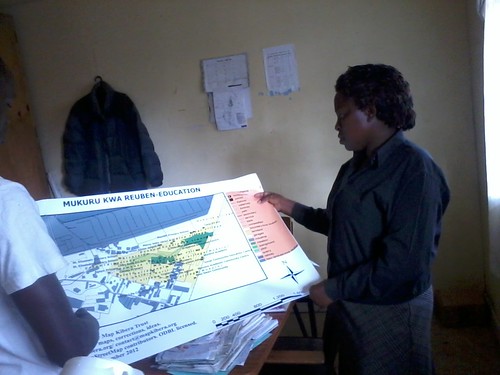
Late last year, Map Kibera formally wrapped up work under the UN Habitat Youth Fund. This small grant gave the members of Map Kibera Trust themselves the space to implement a mapping project from start to finish. From project design, budgeting, entry into the community, training, data collection, community meetings and discussion, map design, and distribution … from start to finish, the guys from Kibera and Mukuru have led the process. A learning experience, so it took a little more time than expected. The results are great, Mukuru is mapped, the members have grown incredibly, and the slum continues to be one of the three active areas for the Trust. So thank you to UN Habitat.
Map Kibera has been working hard for the past several months to be ready for this Monday’s historic election. What are our team members doing to promote transparency and accurate information in the slums during the elections? Read on and follow us during the election in Kibera, Mathare, on Twitter and Facebook!
We have every member plus extra trained volunteers reporting by SMS from every polling station in Mathare and Kibera, and some in Mukuru slum. They’ll be out and about with special t-shirts and press badges looking for important news. Their reports will appear on Voice of Kibera and Voice of Mathare throughout election day. Reports will be approved by the coordinators of each team, who will also verify. We welcome anyone to send in your reports to (0726300400 – include location word Kibera or Mathare)! Reports are also integrated with Uchaguzi.
Kibera News Network and Map Mathare video team will be providing video coverage of polling in Kibera and Mathare. They’ll be editing and uploading throughout the day. KNN has already produced a number of election related videos such as one on one interviews with the local MP candidates, and Mathare has also covered some important events. Screenings will be taking place locally this weekend. Also, expect continual election coverage over the next week.
Coordination: Recently, the Kibera Civic Watch Consortium was launched to bring unprecedented coordination among community media and civic organizations in Kibera. Members include Pamoja FM and KCODA. Map Kibera has also built networks with first responders, national security officials, peace organizations and other important groups to access, contribute, and respond to information coming in during the election period.
Election maps have been created and distributed by our teams. These maps show the boundaries of each ward, previously not known to most slum residents, and marking their polling stations. These maps have been distributed widely to great fanfare in Kibera and this weekend the Mathare team will be covering distribution of their map throughout the slum. This voter information drive will help ensure that everyone knows where and how to vote. Look for upcoming separate post with downloadable maps.
Several weeks ago, our Security Map was painted on a prominent wall in Kibera demonstrating the likely places for insecurity and safe spaces.
Longer form blogging about the election will also be updated and can be found on the Voice of Kibera blog, and Voice of Mathare blog. These stories also will appear as reports on the Ushahidi sites.