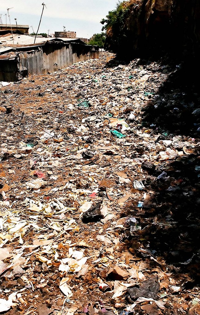
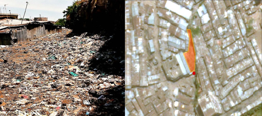
Our teams have started with comprehensive thematic mapping of Water and Sanitation. Most of the things that we set out to map, such as water points and toilets, were pretty straightforward, but there were also some unknowns – like open defecation areas.
What is an open defecation area (ODA)? This is an area which is used by people to relieve themselves where there aren’t enough toilets for all or where people can’t afford to pay to use the toilet (more about it here). These areas are usually also dumping sites for “flying toilets†and other garbage, but mostly for excrement. People use them either early in the morning or late at night so others can’t see them.
We didn’t realize that this is such a big problem until we saw it with our own eyes. They are a huge health risk because they are usually situated in the middle of a very populated area and it is not an uncommon sight to see children playing near or even on top of them. They are also an indicator that something is terribly wrong with sanitation (especially toilets) in the slum.
So how do we map these areas? The first idea was to stand in the middle of the area and collect a point. We dismissed the idea as soon as we saw the expanse and the state of these areas. Most of our mappers come in flip flops and aren’t well equipped to walk there. So we decided we’re going to take a point near the ODAs, later search for the point with the help of satellite imagery and digitize the area. This way we’ll learn different techniques in mapping, get the exact area (in square meters) of all of the ODAs and therefore the whole area in Mathare which is covered by them.
Below are two examples:


Hi Map Kibera!
I’m a student in a collaborative graduate program at McMaster University and the United Nations University – Institute for Water Environment and Health (UNU-INWEH) in Hamilton, Ontario, Canada.
I am working on a project in Il Ngwesi, Kenya (close to Nanyuki) whose long term goal is to assist with a community-based water and sanitation intervention. My contribution will involve the mapping of the area, including water and sanitation facilities (or lack thereof) in parts of Il Ngwesi.
I have been reading your blog, and have been learning lots from it. I have had trouble finding an email address to contact you guys, but I would love to talk to someone in your group if you’re willing. I am currently planning my field work, and have a few questions your experience may help me answer. My email address is barberh@mcmaster.ca, and my blog for UNU-INWEH is http://hilarybarber.wordpress.com/.
I look forward to hearing from you.
Sincerely,
Hilary